Showing posts with label airstrips. Show all posts

Thursday, November 27, 2014

Lost airfields of the Central Coast - Woy Woy (AKA Ettalong)

Woy Woy Aerodrome was constructed in 1942 as a 'dispersal' airstrip for the Fleet Air Arm of the Royal Navy. The airfield was built as a satellite of Schofields.


The airstrip ran north to south next to what is now Trafalgar Avenue, Woy Woy. It was constructed from compacted red gravel. The red gravel may still be seen (if you look hard enough) along the edge of the road surface in some places. As Trafalgar Avenue has a slight bend at the northern end it's unclear to me exactly what the alignment was, however it was of a substantial length roughly parallel with current day Trafalgar Ave. 

The hangars and service area were located in what is now Alma Avenue. Some hangars or support may still be in existence, perhaps much modified, used as warehouses or other industrial buildings.
I have looked at these building but without looking inside and out the back it's hard to be certain of their vintage.

The airfield was last used in 1946 and officially closed by 1950; the land subsequently developed for residences. A last-ditch stand was made to preserve both this strip and Tuggerah to the north as emergency landing fields between Sydney and Brisbane but as the reliability of commercial aircraft improved the need for such airfields declined. An anti-aircraft battery protected the airfield, located in Blackwall Mountain Reserve to the north and east of the strip.

From time to time artifacts, including aero engines and drop tanks have been found discarded and buried alongside the strip. More details may be found on Steve's All things Woy blog and a reworded version with slight differences here and a crash landing in 1950.

Another post by me on this strip.

Want even more? Here is an updated list of Sydney's airports.   

Tuesday, June 15, 2010

The type of emotional rhetoric used to close an airport - in this case Hoxton Park but today's events will lead to more calls for Bankstown to close

It's obviously a traumatic and sad event when an aircraft crashes with a loss of life - and we don't need local agitators jumping on the bandwagon. But they will. Of course aircraft don't crash on approach or departure from Bankstown as regularly as cars and trucks crash on our roads - far from it - yet the fear campaign will be all about the unsuitability of having an airport adjacent to houses, schools and offices. It may be a statistically low risk but it's an emotive issue, especially so immediately after a crash occurs. It's ghoulish and sad that people will use this event in a manipulative way, but it will add to the aircraft noise debate (arguably the real issue) and may eventually cause Bankstown to be reduced in scope, or to close. Perhaps.

Sometimes issues just mount up and force a hand. Further to the west of Sydney Hoxton Park has closed, at least partly because of the fear campaigns of elected parliamentary members just "doing their job", and partly in aid of a bigger transport picture involving airport privatisation and development. The end result is another airport closure, putting more pressure on existing facilities - like Bankstown.

Now Bankstown airport has been around a long time (planned in 1929 but built during WWII) and pre-dates much of the industrial and residential development that now surrounds it. Indeed it is hemmed in and further growth is impeded. And as Sydney's airfields have closed - many of the WWII airfields such as Castlereagh or Fleurs lasting only into the '50s or at best early '60s - others have taken up the slack, like Bankstown, Camden, Wedderburn and The Oaks (despite the quote below very much an active field) . Be they the late lamented Naval Air Station at Schofields or the more recent closure of Hoxton Park the loss of landing strips forces light to medium aircraft users, owners and operators into either more distant airfields like Wedderburn or The Oaks or into busier ones like Bankstown. And we aren't actually opening any new ones, are we?

By the way I'm hardly a silvertail (read below for the bald faced rhetoric), having grown up in Marrickville in the 60's. I don't fly any more but the point is that private pilots can come from any socio-economic background. That's what our egalitarian society is all about - opportunity coupled with fairness and social mobility. Or is that just rhetoric as well?  

Hoxton Park Airport - 07/05/2002 - NSW Parliament
Mr LYNCH (Liverpool) [4.41 p.m.]: I ask the House to note as a matter of public importance Hoxton Park Airport and the surrounding suburbs. Hoxton Park Airport is located within my electorate and it is the subject of considerable controversy. Both in terms of the safety of residents living around it and in the amenity of their neighbourhoods, a substantial number of people have been calling for the airport's closure. The suburbs surrounding the airport include Cecil Hills, Green Valley, Hinchinbrook, Hoxton Park and West Hoxton. I have called for the closure of the airport on previous occasions, and I restate that call today. I have raised this matter on a number of occasions in this House. Indeed, I debated an urgent motion on the matter in 1999. It is appropriate to raise the matter again today because only several weeks ago there was a further accident at the airport.

Hoxton Park Airport is a general aviation airport. It covers 85 hectares and has one sealed runway that is 1,098 metres in length. It is open 24 hours a day, seven days a week. However, circuit training is restricted to between 6.00 a.m. and 11.00 p.m. on Mondays to Fridays, 6.00 a.m. to 10.00 p.m. on Saturdays, and 6.00 a.m. to one hour after last light on Sundays. It caters to both fixed-wing and rotary-wing aircraft, that is, planes and helicopters. It is usually busier on weekends than on weekdays, which says something about the people who are using the airport to train. As I understand the evidence, an average of about six or seven planes are in the air around the vicinity of the airport at any given time.

The airport was originally constructed in about 1942 as part of a group of airfields to be used as aircraft dispersal fields in anticipation of a Japanese air attack. Others included Menangle, Bargo, the Oaks, Wallgrove, Fleurs, St Marys, Castlereagh, Pitt Town and Ettalong. Interestingly enough, none of those airfields is currently operating as an airport. RAAF pilots also used Hoxton Park Airport for training purposes and the like. After the war the airport was leased to the Hardy Rubber Company for use as a tyre test track. Eventually its use as an airport was resumed, but its current use is very different to what it was then. It is now used overwhelmingly for training purposes.


Speaking of developers eating airports, how about Cooranbong, north of Sydney?

Bankstown, Mascot and Hoxton Park are clear examples of developers gradually surrounding an airfield and then absorbing it, either completely or at least on enough sides that the airport becomes "hemmed in" and unable to operate optimally - or to possibly expand (short of reclaiming Botany Bay, for example). And then the complaints start. The noise and the "danger" of it all. As if getting hit by a motor vehicle wasn't an order of magnitude more likely.  

I mentioned also the pressure on Warnervale airport due to changing patterns of land use and the incursion of residences into flight (and thus noise) zones - and then I stumbled on another airfield with an interesting history as well as pressure to convert and rezone its use: Cooranbong, to the northwest of Warnervale.

"Heritage Impact Assessment of the Cooranbong Aerodrome in the context of potential rezoning and a concept master plan. The property has been assessed to have some local community heritage value, primarily for social and historic association, in the use by the Adventist Aviation Association, established 1973, and their aircraft assisted volunteer country outreach and missionary programs. There are secondary levels of significance, such as the formation of the main strip by early Adventist community members in the late 1940s, and the development of a flying school in the late 1970s. The size and scale of the airstrips form distinctive landmarks when viewed from the air.

The proposal sets out the re-zoning of the site to allow for future development, and the concept master plan comprises pockets of developable areas set within retained areas and corridors of natural bushland. The airstrips have been incorporated into the future road patterns planned for the site and will remain prominent elements that contribute to the heritage nature of the place. Areas of open space allowing for specific heritage interpretation are planned into the scheme."


In many ways transport has defined European settlement in Australia and set the pattern for development. Where we found a sheltered haven we built a port. Where we laid tracks towns formed. Where roads joined or rail was laid junctions were created and new focuses and possibilities came into being. It's the timing of transport development that gradually shaped where we lived. Obviously we had reasons other than transport alone - arable land, water and adequate shelter were all factors, sometimes key ones. The Central Coast relied for many years on timber felling for example, which led to a need for tracks and trails, railways and ports. We then link isolated towns and create alternatives to the ports, leading to a de-emphasis on one mode of transport. It is this decison making - or perhaps non-making - that shapes our direction. Cooranbong is an interesting example of this:

"Cooranbong was an important river port with up to ten ships trading here regularly for timber and agricultural produce. The town had a courthouse, shops, hotels and a ship yard. When the northern railway was coming, it was expected to pass through Cooranbong with a branch line to Newcastle and the main line to pass under the Gap as it went further north. The town’s people saw the town as the administration centre of the south. But the line was eventually built through Morisset and over Dora Creek. This prevented the sailing ships from coming up the river and Cooranbong rapidly went into decline dropping the population from 700 to less than 200 in five years. About that time the Adventists arrived and moved the town a mile to the east ignoring the old town and to a large degree, the local people."   

‘Cooranbong’ is from an Aboriginal word meaning rocky bottom creek or water over
rocks. This is Awabakal peoples land. 

And Cooranbong also has an interesting aviation history:

"Between 1932-37 a few local aviation enthusiasts including Albert Harris built a Piertenpole, a high-wing monoplane, in the fowl houses and tool sheds in different parts of the town. The plane was made from crude parts including a ten-year-old, four-cylinder motorcycle engine; a homemade contraption mounted underneath the wing as an airspeed indicator, and barrow wheel tyres. The only instruments were an oil pressure gauge and a rev. counter.
"

First flight was from "Miller's paddock", now Meyers Crescent, off Alton Road.
Don't try landing there now.

With an early airfield as well...
"The same enthusiasts made the first airstrip on the southern side of Cooranbong near the Post Office (near present day Martinsville Road). The site was bounded at one end by a dry creek and at the other end by telephone lines. It was 300 yards long. The Civil Aviation minimum requirements at that time were 500 yards. Despite not meeting regulations, the site is reported to have been used by the group until the outbreak of WWII."

 Don't try landing there, either.

And interestingly there's a link between Cooranbong and 'Wamberal airstrip':

"Harris and the other notable local enthusiast, Frank Wainman, put a second remodelled plane together. Intermediate tests with some crashes were performed on the first early Cooranbong strip, however the main tests for that plane was at Wamberal airstrip. Frank Wainman’s first solo trip was during one of these tests at Wamberal and resulted in the wreck of the second plane."


And the current - now closed - airstrip was created by clearing land circa 1946. And an east-west strip was added circa 1977 and other upgrades led to a flying school being established. It's a fascinating history well worth reading at the heritage planning site I have been linking to.

That heritage impact assessment document concludes negatively in regard to conserving the airfield itself but recommends using the runway alignments as a feature of any new development. The argument sounds reasonable in a heritage sense but does mean that another aviation resource - and one hard to replicate - is lost. But we'll have a memory imprinted in the roadscape, won't we? Better than nothing, I suppose.

Making Time for Flying: Moisture in the air and water in the tanks
I flew past the Cooranbong aerodrome, which is no longer used as one can tell from the big white crosses at the threshold of each runway. It's sad because it looks like a very nice airport, with a long sealed runway. Apparently, Avondale College used to run an aviation degree out of here up until 2006.
Hmmm, no, I wouldn't land there, either. And this is what we've lost (all images via Google Maps):
Still, it's a free country. Well, it's free in some senses. And in the end economics - and regulation - win. The airport (and the adjacent Avondale College) shown above was developed by the Adventist organisation over many years. It's their back paddock, after all, and they need to make best economic use of the land they can, within the laws of the land and the bounds of their beliefs. So be it.

The airport was just an idea, a concept, in 1946, and was 'opened' in 1949. It's quite an interesting story in itself. 

Checkout my list of Sydney and surrounding airstrips and airports.

Warnervale - an active airstrip north of Sydney

I feel like I'm cataloging airfields now, but each has a rich history and I intend coming back in due course to fill in the blanks.

Warnervale is in the Wyong district north of Gosford. It's an important regional airfield and one of the few remaining strips between Sydney and Newcastle. These days we have to catch a train or drive our cars first if we want to fly... and whilst flying is not the most fuel-efficient method of transport it's hardly going to be enhanced by extra car or truck journeys, is it? Alas airfields tend to secure an expanse of grass for runways and overruns, eventually attracting developers bent on turning the "wasted" grassy fields into houses or industrial estates. The airport itself may attract additional investment, leading to jobs, and further development. Which is a downward spiral leading to airport closure when newly local residents complain about the aircraft noise. Warnervale is secure for now but the fight to remain active is always on the horizon.  

Making Time for Flying: Moisture in the air and water in the tanks
After Patonga I adjusted my heading slightly toward Warnervale at 3500ft, with still lots of clouds in the Kariong area. I found Warnervale aerodrome, which is not really a challenge given its prominent location between the Pacific Highway and Tuggerah Lake. One lonely Cessna 152 was doing circuits at Warnervale. I made a call on the CTAF frequency advising everyone I was overflying the aerodrome and kept tracking north.
Here is an updated list of Sydney's airports.  

Monday, June 14, 2010

Wedderburn, Wallacia, Wilton: the hidden airfields of Sydney starting with "W"

I've become a bit obsessed with the subject of the airports, airfields and landing strips that either exist now or existed once in the greater Sydney region. You may have noticed a few posts on this subject recently... well here's another one!

I have previously mentioned Wedderburn. Wedderburn airfield has a single runway, 17/35 measuring approximately 950 m (3,120 ft) long. There are some interesting historical pics in the Sport Aircraft Club's gallery from the Campbelltown City Council collection. It's a post-war private field that has grown somewhat since closure of Hoxton Park.

I should mention Wallacia. Wallacia airstrip was on Park Rd, Wallacia. It is no longer in use, indeed it's not really visible to me at all - not a trace! I also have found little historical information on ownership or use. I do know that it was adjacent to a Wildlife Park (Bullen's Animal World) and was used as carparking during a music festival in 1971.

Wikipedia says this about Bullen's Animal World:  
Bullen's Animal World was a circus style theme park located at Wallacia on the outskirts of Sydney. Its address was 11 Park Road, Wallacia. It was opened in 1969 by Stafford Bullen, the son of circus founder Alfred Percival Bullen, and operated until 1985.

And there's Wilton, of course, an active former WWII "dispersal strip" with 3 crossing runways in a triangular arrangement. At least 2 runways are visibly operational. Wilton is a skydiving centre with  some growth occuring since the closure of Hoxton Park airstrip. Wilton is located along the Hume Motorway, south-west of Sydney.
Wilton was considered as the site for the "2nd" major airport for Sydney but after much opposition and consternation plus decades of indecision Badgery's Creek is the current formally selected and 'semi-funded' site. We'll see what happens, I guess!


or checkout my list of Sydney and surrounding airstrips and airports. 

Last post on this for a while - gliding out of Camden - a potted history of that airport

Camden Airport is roughly 50km (by air) south and west of Sydney. Originally a private airfield, or perhaps paddock, it was seconded for RAAF use as No 13 Operational Base, Camden, early in WWII.

Camden airfield was constructed circa 1935 on what had become the  Macarthur-Onslow family property. The actual original settlers in this area were indigenous, of course. Likely there were populations of Gandangara to the south, Darug to the north and Tharawal people to the east. Some evidence probably remains on the site.

Post-invasion and before the Macarthur-Onslow family moved in, circa 1812 around 400 acres of land beside the Nepean River was granted to Rowland Hassall. The property was named “Macquarie Grove” in honour of Governor Macquarie (who had of course granted Hassall the land). In 1877 however the land passed on, into the hands of the Hon. H.C. Dangar MLC (the Dangars were prominent players in the Colony). Dangar may have introduced a rifle range into the southern end of the property and may - possibly, by at least one account - also have established a racecourse (isn't there always a racecourse involved somewhere?) which remained on the site until the flying school began operations c.1938.

After Dangar the property passed through several hands until purchased by F.A. Macarthur-Onslow in 1916 - in his wife Lucy’s name - or was it Sylvia? (2 sources, 2 wives - hmmm.) So we should say Lucy/Sylvia bought it, but that's not how these things worked, is it?

Anyway, circa 1921 a remarkable Australian aviator of aircraft design fame, Edgar Percival returned home after service with the Royal Flying Corps and opened a small commercial aircraft business. Percival landed on the Macarthur-Onslow property in 1924, and proceeded to inspire the three Macarthur-Onslow sons, Denzil, Edward and Andrew to pursue aviation careers. A film was also shot on the property, involving horse racing and an AVRO 504 (piloted by Percival, apparently!)

With the help of H.E. Broadsmith they designed and built their own aircraft, the B4. Broadsmith was one of the partners (with Nigel Love) in an A.V. Roe (Avro) agency under the name of the Australian Aircraft and Engineering Company Ltd, based at Mascot.

Edward Macarthur-Onslow, a member of the Camden troop of the 1st Light Horse which used the pastures of Macquarie Grove as a parade ground bought his first plane, a Hornet Moth, in 1935 and this and the Comper Swift owned by brother Denzil were housed in a garage on the property. The family also established the Macquarie Grove Flying School in 1938.

Of cousre we all can guess what happened next. In 1939 the newly-christened Macquarie Grove Aerodrome (and hangars) were seconded - happily handed over, really, although the family expected it back - by the Commonwealth for war purposes. Work began on the airfield to clear approaches and install about 50 prefabricated huts. The 1st Light Horse Garrison moved in to patrol the aerodrome. Camden became home to perhaps seven squadrons that undertook training, anti-submarine, convoy escort, reconnaissance, general air and meteorological tasks. The squadrons included No 457 Spitfire Squadron which arrived in November 1942 and No 15 General Reconaissance Bomber Squadron (equipped with Beauforts), formed at Camden in January 1944. A substantial US Army Air Corp contingent was based at the airport as well.
RAAF Station, Camden was handed to the Department of Civil Aviation (note - not the Macarthur-Onslow family, who remain a bit taken aback at this move) on 15 September 1946. Ownership subsequently transferred to the new, more commercially-driven Federal Airports Corporation in 1988. That's when the "user pays" principle really kicked in and pressure was put on existing users to make the most of their presence on the airport. Or move.
Further paper-based 'ownership' changes occurred in 1998 to Sydney Airports Corporation Ltd and then division of that body into a separate Camden Airport Ltd in 2001, pending privatisation (by long-term commercial lease) in 2003.

Here's a useful location map which may be found in the 2010 Camden Airport Master Plan (see link at end, if you must).
My first experience of Camden was as an aircraft-mad Marrickville kid growing up in the mid 1960s - and my recollection is much as the 1953 description below. Very much a "WWII RAAF airfield" feel with the gate house and raised gate, the house on the hill and the buildings on the hillside, the twisting road down to the hangars and so on.

Of course there was also the Camden Museum of Aviation, an absolute must-see at the time. Sadly the museum, like other hangar-based museums at the time, was "moved on" in recent years to make way for "real" aviation activity. I guess it was cheaper than building another hangar but the museum really hasn't re-opened since.

That's probably a Camden Aero Club DH Tiger Moth, circa 1969, right there.

My next recollection would be around 1976 or so, flying into Camden in a Cessna 150 and a Cherokee, practising touch-and-goes. I did taxi there, too, and the WWII-era RAAF Kittyhawk-width grooves were certainly for real.

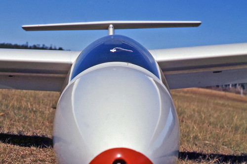
And then again in the very late '70s or possibly early '80s (I really can't remember!) I took off and landed a German-built sailplane there, on a grass strip. As a powered-flying pilot I found a long, shallow and quite fast approach somewhat harrowing, especially given a successful go-around was unlikely!
 
Finally the airport had a complete revamp, new tower, the museum was booted out and eventually new private owners took charge. I haven't been there since.


Here's an historical gliding snippet. Click on the link to read it in full.
 
Southern Cross Gliding Club, Sydney
The aerodrome area was originally a race track owned by Arthur Macarthur-Onslow. In 1919 a film called "Silks and Saddles" was being made which required a race between a horse and an Avro 504K, and the Camden track was ideal for shooting this sequence... ...Camden became Australia's first private aerodrome. Edward Macarthur-Onslow became a great personality in aviation and formed the Macquarie Grove Flying School which by 1939 employed more than thirty people in the workshops at Camden Aerodrome servicing about a dozen aircraft at all levels, including engine overhauls and propeller manufacture.

When World War 2 came, Edward Macarthur-Onslow made the aerodrome available to the Commonwealth Government "for the training of Australian war pilots". Then the RAAF moved in, and then the Americans, the elegant Macquarie Grove House on the aerodrome was turned into an officer's mess and the sergeants made even more of a "mess" of Hassell Cottage at the top of the hill... ...What the gliding people saw in 1953 was an almost intact example of a WW2 Air Force training base. Near the top of the hill at the bend in the road was a sentry box with boom gate and khaki painted wooden huts stretched in rows right down the hill to the hangers which were full of unwanted aircraft, mainly Avro Ansons... ...That so much should have remained in 1953 was remarkable. But no one else visited the place and it was like an old movie set of WW2. The gliding people were even given the use of a few wooden huts.
Camden still looked much like that in the late '60s and early '70s, sentry box, boom gate - the lot.  However things changed as a new control tower was built and the old museum was (im)politelty moved on.

Currently there are 17 hangar buildings and 100-150 movements per day, peaking at about 200 (2010 figures).  There are 2 main runways, 06/24 (main, lit, 1464m) and 10/28 (grass, unlit, 723m) plus 2 grass gliding strips in parallel (or almost!) to the main runways. Most aircraft movements are single-engined but the glider movements are not counted so who knows for sure?

I have some more Camden pics on Flickr (account: gtveloce).

An extra note here is the training status of Camden:
Camden, NSW is recorded as being the only Central Flying School (CFS) in the
country as at December 1941.34 This seems to be the case as sources claim the
CFS moved to Tamworth RAAF Base.35 Table 1 therefore lists the CFS as the
principal function at Tamworth.


There's even a master plan with more maps and a wealth of detail.


or checkout my list of Sydney and surrounding airstrips and airports. 

The first glider flight in Australia (excluding box kites) - 1909, Narrabeen. Mentions also of Cronulla, Granville, Bunnerong

I've already quoted from the excellent Gliding.com.au site but here I go again, just for the record.

The first glider flight: Southern Cross Gliding Club, Sydney
The first "glider" flight in Australia was made in December 1909 by George Taylor at Narrabeen, NSW. A special memorial has been erected opposite the Narrabeen Post Office to commemorate this feat. Taylor's partner was a young fellow by the name of Edward Halstrom who was to become a household name in Australia for his gas powered Silent Knight home refrigerators of the 1950s and his private zoo of rare animals.

Did you realise that there once was a Granville glider club? Or that they test flew at Duck Creek, Auburn? Well it was a while ago... but on the other hand I can remember the odd paddock strung along Parramatta Road in that area from Homebush to Parramatta, persisting until the 1970s at least.
 
Southern Cross Gliding Club, Sydney
I spoke to Stan Rose who was later to become Secretary of the Southern Cross Club about the early days. In 1930, he saw the Granville Club's glider and was very impressed with it. Being a lad of 15, he went home and found a design of a hang glider in "Chums Annual" and decided to build it. It had about a 5 metre wingspan and was made of bamboo tied together with cord fishing line.

When the wings were ready for covering the only logical material was some bed sheets and these proved ideal although his mother put on no end of a performance when she found out. Ah, one of the first of many little differences of opinion caused by gliding.

So with the wing covering held on with flour and water glue, it was ready for test flying. The site was Duck Creek at Auburn and it was blowing a good westerly. Stan got up a bit of a run and with a good angle of attack, the thing jumped about five feet into the air. Next it dropped one wing, zoomed into the creek and clobbered the only tree stump in sight.
Gliding - or perhaps hang gliding - is not a surprise at the Cronulla/Kurnell sandhills.

Southern Cross Gliding Club, Sydney
Harry Ryan, who was later the CFI of the Southern Cross Gliding Club, was one of the early pioneers of gliding. He had his first flights with Martin Warner and Alf Pelton who operated a German Primary glider from the sandhills at Cronulla in 1931.
But Bunnerong Park is a bit of a surprise. Especially in the dark.

Southern Cross Gliding Club, Sydney
Another group was started by Jack Munn who designed and built the Falcon. They formed the Sydney Metropolitan Gliding Club and flew at Bunerong Park, about a kilometre from Mascot Airport. They flew by day and night and records show that the group often flew until midnight if the moonlight was bright enough. To help with night landings, a motor bike headlamp was fitted to the front of the machine and a motor bike battery tied inside the nacelle. When coming in to land, at a few feet off the ground, the pilot used his left hand to clip a lead onto the battery terminal.


Another "known unknown" airstrip near Sydney - Wedderburn, south of Campbelltown

NSW Sport Aircraft Club - Wedderburn
Become a member of the NSW Sports Aircraft Club Inc. and enjoy the general experience of belonging to a club dedicated to the private ownership of aircraft and to the comradeship of the aviation fraternity. Wedderburn was founded as an inexpensive venue for members to fly, house their aircraft and fraternize with aviation minded people. And it continues to adhere to those principals today. So ideally it is the Flying Club there for your pleasure---- not simply a place to park your aircraft.


Here is an updated list of Sydney's airports.  

Sydney's Castlereagh dragstrip, formerly a WWII RAAF 'dispersal' airstrip

In my memory it's an airstrip marked on some 40's and even '50s Sydney street directories, well north of Penrith on the road between that city and Richmond. Later it became marked on maps as a dragstrip, before that too was closed and drag racing moved to Eastern Creek.

A composite map I made from Google Maps and Penrith City Council maps. It's approximate but pretty close (I think) to the airstrip alignment. If you view that location on a Google map you can see the faint outline of the airstrip on that south-west-north-east alignment.
 
According to Penrith City Council records drag racing was held on the site of the original Castlereagh Airstrip, used as an 'emergency strip' during the 1930s and during WWII (when it was a dispersal strip for RAAF Richmond). While drag racing had taken place as early as 1947, it wasn't until 1959, when the Australian Racing Drivers Club (ARDC) took over, that 'official' or organised racing began. This was the first recorded instance of "U.S.-style" dragsters racing in NSW. The 40 hectare area was leased from Walter Properties Pty Ltd, presumably the post-war owners of the airstrip land.

Subsequent to the ARDC's operations racing was also organised by the Manly-Warringah Sporting Car Club from 1962 to 1965. The NSW Hot Rod Association ran races here after that time.

The name of the track was changed to "Castlereagh International Dragway" c.1971 and racing continued until 1984, when the track was closed. An earlier threat occurred in 1982 when Penrith Council put in a development application to remove gravel from the land in Hinxman Road. However the council resubmitted its application excluding the drag strip from the application.

Closure came when the dragway lease on at least part of the land owned by Walters Properties expired in April 1984. The owners chose not to renew the lease, instead entering into a joint venture with Oakes Building Co. to develop a total of 115 hectares into 54 five acre blocks. This was to be called the Castlecrest (or possibly Castlereagh) Country Estate.  

Wikipedia's description: "Castlereagh Aerodrome was a Royal Australian Air Force (RAAF) emergency landing ground and dispersal ground during World War II at Castlereagh, New South Wales, Australia. The runway was 5,000 ft long (1,500 m) x 150 ft wide (46 m). The airfield was to become home to No. 94 Squadron's Mosquito aircraft and had been upgraded by No. 9 Airfield Construction Squadron, however the aircraft did not arrive before No. 94 Squadron was relocated to RAAF Base Richmond and disbanded. After disposal by the RAAF, the airfield was used as a drag strip from the early 1960s eventually closing in April 1984, becoming Castlereagh Country Estate."

OzAtWar says this: "Castlereagh airfield was used as an Emergency Landing Ground (ELG) during WW2. In 1947 the airfield was used as a drag strip. The Australian Racing Drivers Club took over in 1959 and it was from this time that US style dragsters were raced in New South Wales for the first time. The Manly Warringah Sporting Club managed the complex from 1962 through to 1965. The NSW Hot Rod Association then took over. It became known as the Castlereagh International Dragway in 1971. The drag track eventually closed in April 1984. The area then became part of the 115 hectare Castlereagh Country Estate comprising 54 five acre blocks. The north western end of the Castlereagh airfield started east of the southern end of West Wilchard Road and ran north east up to Hinxman Road. It crossed Sheredan Road near the intersection with Jolly Street."


or checkout my list of Sydney and surrounding airstrips and airports. 

Fleurs, the US Navy, a WWII airstrip and the CSIRO

Fleurs is located in western Sydney along Elizabeth Drive out of Liverpool. Kemps Creek is close to the south east and Badgery's Creek is south west. It was the site for a US Naval Air Wing during World War II with a host of satellite airfields nearby. Kind of ironic that we let this infrastructure slide after the war, only to have to rebuild it nearby (if on a far grander scale) just a few decades later.

So what was Fleurs? Of course it would have been home to generations of indigenous people before it became an aerodrome, after which is became an airfield popular amongst post-war gliding clubs.

After that the CSIRO established a radiophysics facility that was handed over to firstly the University of Sydney and then to the University of Western Sydney. Nowadays it looks at least partly privately-owned (or leased?) with at least a substantial portion remaining in public ownership. At least that's how it looks - you may know more!

Anyway, here's a location map, courtesy Google maps (my extra edits though): 
Wikipedia has this to say:

Fleurs Aerodrome - Wikipedia, the free encyclopedia
Fleurs Aerodrome was a parent aerodrome built on behalf of the Royal Australian Air Force near Penrith, New South Wales, Australia during World War II.

Construction started on the aerodrome in 1942 and was still under construction in 1944 as part of a proposal to base a United States Navy Fleet Air Wing in Sydney should the need arise. Initially planned with three runways, No.1 (5000ft) and No. 3 (6000ft) runways were serviceable, however construction of No. 2 runway (5000ft) was abandoned. A total of eight aircraft dispersal hideouts were constructed and accommodation was a farm house and a former Civil Constructional Corps camp.

In 1969, Fleurs was considered as a site of the second airport for Sydney. The aerodrome is now utilised as precision ground-reflection antenna range operated by the University of Sydney, known as the Fleurs Radio Observatory.
Well, it was an Radiophysics observatory. Not any more, though! And no, I haven't managed to pin down that suggested operational 2nd runway, although I'd guess it crossed the obvious remaining strip and ran roughly northwest by south east, based mostly on the available land. The image I've made (below) combines a map available from the earlier CSIRO link (above) with Google's data... as I said, at least one runway is plain to see!
 And what were these "parent" aerodromes, satellites and "dispersal fields"? Well (apparently)
"...Satellite aerodromes were constructed to alleviate congestion at ‘parent’ aerodromes. The degree of congestion at any of the ‘parents’ could be indicated by the number of satellites. For instance, in Western Sydney between Blacktown and Penrith (at the foot of the Blue Mountains), Fleur
had five satellites. Fleur was a Station for the United States Navy Fleet Air Arm (USN FAA). As Australia needed the assistance of the US with its extensive defence assets, the government considered it appropriate to provide any necessary infrastructure from which the US fleet could base itself in the southern hemisphere. It was an objective of the US Navy to have one ‘parent’ and six dispersal airfields in the Sydney region and Fleur met this requirement. The presence of the US in the State and at its aerodromes is obviously significant due to their success in the South-West Pacific Area campaign."


Post-war there is an extensive history of gliding (or sailplaning) at Fleurs. The primary driver appeared to be the Southern Cross Gliding Club, although several other clubs were certainly present. The club moved operations to Camden aerodrome c.1954 citing "smooth runways" and "the CSIRO were coming to take Fleurs anyway". Fair enough then.  

Interestingly there's a private airstrip at Luddenham, just 6km or so from Fleurs. (If you check it out today on Google Maps you'll find what looks like a Cessna 337 parked outside a small hangar.)  


There are 3 wartime images on Flickr showing a bit of real, historic Fleurs activity: a Bell Airacobra (and again, but maybe not Fleurs?) and a suspected '24 Oldsmobile.And the State Library of NSW has a general ground-level view of of Fleurs: "40 degrees from crest at 3950 foot on runway looking south west".

As an aside, here are some Sydney gliding history dot points (and yes, I have flown from Camden in a club glider and managed to land it again - just once was enough!):
  • The first “glider” flight in Australia was made in December 1909 by George Taylor at Narrabeen, NSW. It was more like a hang-glider but does it really matter?
  • There was a Granville Glider Club c.1930
  • A test flight was conducted c.1930 at Duck Creek, Auburn
  • Flights were conducted from the Cronulla sandhills, c.1931
  • And Nowra, 1936
  • Narromine, 1940
  • Matraville, 1941
  • Bunnerong (later Heffron) Park, c.1945
  • Doonside, 1946 (close to Fleurs)
  • Fleurs, c.1946 and 
  • Camden at least from c.1953 (probably earlier).   
Some selected sources (apart from Google Maps):
And more to read on this site (just search the site if no working links):
  • Whalan Reserve, a WWII dispersal airfield near Mt Druitt
  • A bit more I also wrote on Fleurs 
or checkout my list of Sydney and surrounding airstrips and airports. 

RAAF Wallgrove Aerodrome - yet more on another Sydney airstrip - AKA OTC Doonside

Getting confused yet? The WWII airstrip at Wallgrove (or Doonside) is just 3km or so from the Fleurs airstrip. Sydney was ringed with the darned things, apparently. This one was located near a WWII US Army base, apparently. It was a satellite airfield.

Wallgrove Aerodrome - Wikipedia, the free encyclopedia
Wallgrove Aerodrome was a Royal Australian Air Force satellite and emergency airfield at Doonside, New South Wales, Australia during World War II.

The aerodrome was built in 1942 and the runway was 5000ft (1524m) long and 150ft (45.72m) wide running NW-SW. After World War 2 the aerodrome was closed in 1946 and reverted to farmland.

A number of former revetments are still in existence and the runway can still be located. A industrial area has been built over the southern end of the aerodrome.
This is Darug people's land and important Bungarribee Creek catchment. The location is also within historic "Bungarribee" farmland in what is now Western Sydney Parklands. Bungarribee is bounded to the west by the M7 Motorway, to the south by the Great Western Highway and to the east by Doonside Road. Some of the airfield has been lost to the south and east by development.


The map is a composite of images found on the web, overlaid on a Google Map view of the area.

"The military’s interest in the site was for the construction of an airfield to serve as a training site and as an overshoot runway for the nearby Schofields airbase. A runway was constructed of compressed gravel with aircraft hides and taxi ways to the south. The runway extended on the southern side of Bungarribee Creek, in a southwesterly direction from close to the junction of Eastern and Bungarribee Creeks, crossing Doonside Road and ending near McCormack Street (Arndell Park), approximately 1.8km in length." NSW Planning "Bungarribee Homestead" documentation
Post-war the site was released by the RAAF into the hands of the Overseas Telecommunications Commission, a government body set up to take over what had been mostly coastal marine HF communications held in private as well as public, including wartime RAN, hands. This new body handled international telecoms in a similar manner to the handling of domestic communications by the PMG. Later OTC was merged with Telecom Australia to form the original Telstra. Telstra being subsequently privatised. More historical detail may be found here.

The Wallgrove airfield site thus became the "OTC HF Transmission (Doonside)" establishment, complementing the "Receiving (Bringelly) station". I presume that's also the RAAF site at Bringelly. Or perhaps adjacent to the RAAF?

Previous to Doonside, Sydney Radio (VIS) was established on a 40 acre site at Pennant Hills in 1912, remaining in place for various services until after the Melbourne Olympics in 1956. 
The Pennant Hills site, as it is now in 2014 (Google Maps image). More Pennant Hills OTC history may be found here. Long-range HF operations were subsequently moved to La Perouse in February 1927. In 1956 a new HF transmitting station opened at Doonside which was remotely controlled from La Perouse. See also this Coastradio site. And this extensive exOTC History.

Sources include NSW Planning, Ozatwar and exOTC.

Don't forget to checkout Fleurs, just 3km by air to the south and west.  Or perhaps Mt Druitt, about the same distance (or less!) to the west.

Here is an updated list of Sydney's airports.  

There is also an excellent heritage study available from NSW Environment and Heritage. On that page search for "World War II Aerodromes and Associated Structures in NSW".
 

RAAF Marsden Park - yet another WWII Sydney area airstrip

Marsden Park airstrip, a WWII dispersal airstrip and later motorsport venue. May have also been called "Berkshire Park", a neighbouring locale. (Or they were two separate airstrips!) Close also to Schofields and Richmond. Marsden Park, despite references suggesting the contrary, is not Pitt Town, another neighbouring dispersal strip to the north and east of Richmond.  
Somewhere in that Google Maps image is a clue to where Marsden Park airstrip actually was...

From the Penrith City Heritage Study, Berkshire Park: "Aerial photographs of the early 1970s show the land west of St. Marys Road was open forest, with a cleared area of the Second World War era diversionary airstrip." The area described, top left of the Google map, is now developed.

Meanwhile, I've found an interesting link between this airstrip and Australian F1 motorsport engineer Ron Tauranac: "Ron Tauranac was born and raised in New South Wales, Australia but lived and worked for most of his life in England. He will be known as one of the great race car designers covering the early Brabhams, the Ralts of the 1970s and 1980s, and less-well known the Theodore F1 car. Ron gained his initial experience of engineering with a local company CSR Chemicals, and bought himself an Austin 7. Out for a drive one Sunday, he came across a race meeting at Marsden Park airfield, near Pittown, Sydney. His interest was sparked, and he quickly met up with the Hooper brothers, of motorcycle repairers Hooper & Napier. The brothers were in the process of building their own 500cc car, using a dirt-track JAP in a very simple chassis." Full story here. 
Marsden Park Aerodrome - Wikipedia, the free encyclopedia
Marsden Park Aerodrome was an aerodrome constructed by the Royal Australian Air Force (RAAF) near Marsden Park, New South Wales, Australia during World War II.

The aerodrome was built in 1942, as a relief landing ground for RAAF Base Richmond, with a runway 5,000 feet (1,500 m) long and 150 feet (46 m) wide. A number of RAAF radar stations; No's 169, 170, 309 & 312 were located around the aerodrome during separate times. The aerodrome was abandoned after World War II and was briefly used as a motorsport facility in the 1950's.
Whilst it's hard to miss a 1,500m airstrip it has been almost 70 years and the land may have been redeveloped or simply ploughed out of existence.

or checkout my list of Sydney and surrounding airstrips and airports. 

Love this story of meeting "Mr Lake" of Lake Road, Tuggerah

Woy Woy.net -A  Woy Woy Weblog
On the way out to the site I saw an old bloke walking a greyhound down the road and I pulled over to ask him if he knew of the airfield.
In a stroke of luck he did indeed know of the strip and pointed over the fence from where we were and said " that's it there " - right in the spot I suspected , he also told me to go see a local further down the road who had lived here all his life.
So I drove to the end of Lake road to see the " Mr Lake " , that was what the greyhound guy called him.


CSIRO radiophysics and RAAF Fleurs - the Sydney airstrip at Badgery's Creek

As I've mentioned several times before Sydney and nearby towns played host to a number of wartime airstrips including The Oaks, Cordeaux, Schofields, Hoxton Park and Woy Woy amongst many others. Some of these remain usable but others were re-used as motor racing tracks or simply became disused.

So here's RAAF Fleur (or Fleurs), another one with an interesting post-war use.

The CSIRO connection - Flowering_of_Fleurs
Fleurs is situated about 40 km west-south-west of central Sydney near Badgery's Creek, and occupies an expanse of flat land between South Creek and Kemps Creek adjacent to a disused WWII air strip. Between 1954 and 1963, Fleurs was the leading field station of the CSIRO's Division of Radiophysics, and was home to three innovative cross-type radio telescopes, the Mills Cross, Shain Cross and the Chris Cross (Figure 1), all of which played important roles in furthering international radio astronomy (Robertson, 1992). This article discusses these radio telescopes, and the research that was carried out at the Fleurs field station.
The Gliding connection - Southern Cross Gliding Club, Sydney
In 1946 the AWA Club moved to a disused wartime emergency strip just west of Cabramatta called Fleurs Airstrip which was only 3 Km away from the Doonside airfield. It was to become more or less a permanent home for gliding operations. Being on the bend of a river, it used to flood regularly and when a hanger was finally built the machines were always lifted up on top of 200 litre drums as a safety measure. On visiting the strip after one of these floods, the first job was always to retrieve the toilet hut which always seemed to be a couple of kilometres downstream.

At the end of '46 things were pretty busy at Fleurs. The clubs operating from there were the AWA Club, Sydney Metropolitan, Cumberland-Phoenix (now amalgamated) and occasionally Sydney Soaring.
Gliding moves to Camden - Southern Cross Gliding Club, Sydney
Late in 1953 the NSW Gliding Association decided to hold a "gliding pageant" at Camden. The Hinkler and Sydney Soaring Clubs were already flying their sailplanes from this site. Although the Southern Cross membership was down to five, they loaded the old Primary onto an antique Bedford truck and decided to attend the pageant as well.

They were very impressed with the long smooth Camden runways and decided not to return to Fleurs Airstrip which was destined to be taken over by the CSIRO for the Maltese Cross Radio Telescope. Besides Camden was totally deserted apart from a few gliding people and a locally owned Macarthur-Onslow Hornet Moth which rarely flew.


Checkout my list of Sydney and surrounding airstrips and airports.

Saturday, June 12, 2010

RAAF Cordeaux airstrip - cut by Picton Rd but still there

5,000 feet is a very useful length of runway indeed. Having it bisected by a main road was probably a bad thing for the long term - that and being out in the middle of the bush. I'd call that Picton rather than Mt Keira Rd (although they basically coalesce anyway). 24 aircraft hides is impressive.

Wikipedia says: Cordeaux Airfield (Landing Ground), Cordeaux Dam, New South Wales, during WW2
Cordeaux Airfield was constructed in late 1942 near Cordeaux Dam in New South Wales as an RAAF landing ground (maintenance) for its parent RAAF airfield at Albion Park.

The airfield consisted of a sealed runway 5,000 feet long and 150 feet wide running NE/SE with twelve aircraft hideouts. Original Works were authorised to build the sealed runway and 24 hideouts. Remnants of the airfield can still be seen today where it crosses Mount Keira Road about 5.6kms north of Cordeaux Dam.


Here's a close-up showing the current terrain (a "fire road") with the original runway and hides as an overlay. I'd bet there's some decent archaeology to be found scattered around those hides.

I made the composite images from Google Maps and OzAtWar sources. Thanks go to both. OzAtWar also has another location map to check out. 

Here is an updated list of Sydney's airports.  

Investigation into Sydney's International Airports - chronology from 1946

I am assuming that in 1946 Sydney's "International Airport" was actually Rose Bay Flying Boat Base. If that assumption is right then this link below takes us back to the decision to anoint the swampy airfield site at Mascot as "the" International Airport of the future. If you follow the chronology a 2nd "major" airport is considered in 1964 when the Towra Point Folly first comes up. Somersby also gets a guernsey in the 1970s, along with Galston and Duffy's Forest. All 3 drew a lot of protest from locals, for good reason. They were also the most challenging sites to build on, so the fight perhaps wasn't that hard to win in retrospect.

As I have pointed out several times it's wrong to say Sydney needs a "second" airport. Sydney already has Mascot, Bankstown, Richmond and Camden plus it had Schofields and Hoxton Park. Not forgetting The Oaks and a bunch of WWII airstrips. Whether it "needs" a 2nd major airport is a harder question to answer.      

Second Sydney Airport-A Chronology (September 2003)
A study is undertaken to determine the best site for the development of an international airport in Sydney. Sites studied include Towra Point, Bankstown and Mascot. Between 1946 and 1968, Federal, State and local governments discuss the Towra Point site, which is eventually ruled out because of environmental difficulties.
Checkout my list of Sydney and surrounding airstrips and airports.

Active gravel runway at Wallsend

WALLSAIR Airport
Wallsair is a collection of 17 like minded aviators who enjoy their flying, from GA to ultra-lights. Conveniently located 4 Nm west of Newcastle, Wallsair has a 750 meter dirt strip oriented 30 and 210 degrees,

Currently 2 Hangars and a Clubhouse.

GPS Co-ordinates

S 32 degrees 52.977

E 151 degrees 40.977

Visitors are welcome, but where possible landings and takeoffs are to be to and from the north. If landing from the south is necessary, approach down the green corridor running south west of the strip. If the strip is wet, land and takeoff on the western side of the centre. Circuits are to be wide to the west around Maryland residential. Beware of HT power lines running along the west of the strip.

Wallsair flyers are all on radio and use Newcastle frequency 132.100 Mhz.

Here is an updated list of Sydney's airports.  

The Entrance Airstrip - gone but not entirely forgotten

I believe The Entrance airstrip was by-and-large at the site now occupied by the The Entrance District Sporting and Community Centre (EDSACC), located on The Entrance Road, between Yakalla Street and Eastern Road. Several people have placed it either side of The Entrance Road, but by most accounts it was on the ocean, or eastern, side. 

In any case, Wyong/Central Coast Council has a photograph and a little more detail of it, here.  

Several alternative locations have been proposed, but that pic establishes that it was close to Blue Lagoon Caravan Park. It's only the alignment of The Entrance Road that appears in doubt.

There is one source that places Bateau Bay airstrip at The Entrance, in the grounds of what is now the Entrance High School. That's probably a confusion of schools. It's possible, but it's very close to the township itself and on sloping ground. It's not consistent with the image, anyway.

The alternative school site at Bateau Bay proper is flatter and better in every way (for an airstrip), barring some 'swampiness'. In accord with the image above, it may have only partly have been on the school site, in any case.

Bateau Bay, New South Wales at AllExperts
* Bateau Bay was once home to an airstrip known as The Entrance Airstrip. The site of The Entrance Airstrip is now within the grounds of The Entrance High School *

Much more likely is a slightly more southerly location, including the sports fields and possibly part of the school site. It is mentioned by a Gosford Aeromodeller: "The first time I spotted radio control models was in 1972 at the old The Entrance airstrip near Bateau Bay. This area is now occupied by sports fields and a High School. They drew a big crowd on Sundays because of the nearby Entrance road. The club however was soon on the move because permanent flying fields were hard to find, even in those days. By the time I had decided to join they were no longer at Bateau Bay and for a time I was unable to locate them." 

So in any case it was closer to Bateau Bay than The Entrance, putting it down on the flatter land to the south on what is now at least partly Tuggerah Lakes College (formerly Bateau Bay High School). This site fits with my recollections as well - although I didn't come to the coast a lot in the late 60's early '70s I could have sworn I saw an old strip down on the flat near the main junction (now a roundabout).

See the comments below, placing the airstrip immediately south of the current school grounds. 

Checkout my list of Sydney and surrounding airstrips and airports.

Friday, June 11, 2010

Taking off from Somersby airstrip, 2007

Below is a description of taking off from the Lackersteen's Rd airstrip, Somersby.

Interestingly there's what looks to be another old, unused airstrip on the other side of Peats Ridge Rd (ie to the north but running more east-west) - perhaps the Somersby strip used to be longer with a crossing strip or L shaped configuration and was cut by the roadworks? I do have doubts about the terrain, though - it may be a bit lumpy just there between the 2 sites.

Print Page - Back To The Nest - Bundaberg 2007
The engine takes a while to warm as the temperature is a bit on the cool side, but we are soon taxying to the run-up area, at the southern end of the strip. The engine run-up checks are all OK and the pre-flight essential check-list complete, so we taxy to the end of runway 35, make our departure call, log the time at 1008 and give the engine full throttle as we turn onto the runway for a short field take-off.

With the T’s and P’s in the green and the ASI rising, we accelerate down the hill that is a characteristic of the Somersby airstrip bouncing over the rough stuff and gently raising the nose of the aircraft for a short / rough field take-off. The Jabiru being full of fuel, two POB and holding a reasonable amount of luggage, is reluctant to leave the ground, but once it does we accelerate quickly in ground effect before raising the nose to the best angle of climb attitude and settling into the climb out. Once clear of the tree-line, we pick up the effects of the cross wind and adjust the flight path to suit. Lowering the nose to the best rate of climb attitude, I allow the aircraft to accelerate to the top of the white arc and then clean up the flaps. Fuel pump off – engine still running (always a good thing) and the rest of the post take-off check list completed T’s and P’s in the green, accelerate to the cruise climb speed of 90 KIAS and then 100 KIAS still gives a good rate of climb.
Here is an updated list of Sydney's airports.  

The Gosford City Aeromodellers at Narara Airstrip

Our Field/Getting Here - Gosford City Aeromodellers
Located at the top of Mangrove Road at Narara, we are very central on the coast and easy to find. There are 2 ways to access the club, from the north and from the south. From the northen end it's easiest to get to the club via Dog Trap road at Ourimbah, which tee's off the Pacific Highway opposite the RSL club and links up with Mangrove road once you cross the freeway. The Southern end is accessed by getting onto Narara Valley Drive and following it until you can turn off directly onto Mangrove road, I would recommend coming from this direction as it is fully tarred where Dog Trap road still has a dirt section.
Here is an updated list of Sydney's airports.