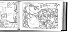
Monday, July 19, 2010

My take on maps and copyright law in Australia - just for the historical record of course

This is a blog that dwells somewhat on local Sydney history - you may have noticed! And this post is partly an explanation and a disclaimer. In short: I do my best to respect copyright. That doesn't mean I agree with it - too often copyright hinders the creation of new material. Historically it has been important that new material reference and build on the past, and I remain in favour of that "fair use" principle. I don't believe in plagiarism or blatant misuse. Thus I respect the law as it stands, applied sensibly.

The longer explanation: wherever possible I cite sources for my material and avoid knowingly breaching copyright. Please let me know if I have stepped on your toes in that regard - it wasn't intentional.

Where I "sample" and mark recent material (with notes or circles) I do so for historical research purposes (ie 'study') only in accord with fair use under the act. I also believe that in all such cases I have only reproduced what is needed to obtain historical context and clarity, and that remains only up to or less than 10% of the original work. This is achieved by cropping or blurring the remainder. Where I have overlayed one map upon another I have not in my view altered or added to the original material, rather I have simply layered one image over another. Where I have reproduced a full page of a street directory or other map either I consider it to be no longer covered by copyright, or to be less than 10% of the original (and complete) work. In that way I do distinguish between a complete work, being a whole publication, and sampled pages of  a complete work. I have not copied any street directory published after 1954 in its entirety, nor do I intend to do so. Again, if I have stepped on any individual copyright owner's toes please let me know. 

And here are some copyright snippets from other sites for comparison... 

The Australian Copyright Council site. A great source of up to date material.

National Library Of Australia | Copyright in maps
Maps published in or before 1954 are free of copyright. For maps published in 1955 or later by a government publisher, copyright lasts for 50 years after the end of the year the map was published. For maps published in 1955 or later by a non government publisher, copyright lasts for 70 years after the end of the year the map was published.
National Library Of Australia | Copyright in maps
Maps still in copyright can be copied for you in libraries under "fair dealing" exemptions of the Copyright Act 1968 for the purposes of research and study. However, you will need to demonstrate that you have followed your obligations under the Copyright Act. For a map in copyright a 10% portion of the map may be copied for research or study purposes only. In practice this usually means one A4 size portion (21cm x 30cm) of the map only. You do not need permission from the copyright owner to obtain a copy of a portion of a map as long as it is used for the purposes of research or study only. Permission is needed if you wish to copy the entire map, or if you intend to reproduce, display, publish or sell the copy.


Sunday, July 4, 2010

I can't resist some relic tunnels, railways and whatnot from NSW shale mines, can you?

Well I find it interesting, anyway. Been there twice, once staying overnight near Newnes. Shale oil mining was big business in the late 19th Century until the early 20th and a raft of mines sprung up in NSW. Tunnels, railway relics, oil refinery equipment - you name it, it's all there to be seen. This post is (you guessed it) about that shale mining. Follow the links to more detailed sites with pics.

Brian Ayling's Airly relics
From 1883 to about 1913, Kerosene shale or torbanite was mined in the vicinity of Airly, a small village near Capertee about 120 miles from Sydney. Transport of shale to the nearby railway was initially handled by a system of roads and horse tramways, but with increased production and the establishment of an oil works at Torbane, some spectacular cable haulage inclines were employed to cross Airly Mountain.

The Airly mines closed after shale production was concentrated in Newnes, and today just a few remarkable relics remain, in fairly secluded bushland.
Brian Ayling's Airly relics
Hidden cottages
Small stone dwellings can be found adjacent to the route of a horse tramway that served shale mines along the eastern slopes of Airly Mountain. Careful exploration either side of the tramway formation reveals numerous hidden gems like these, the example at right being neatly concealed beneath an overhanging rock.
Brian Ayling's Airly relics
Oil works site
Reward for a climb to the crest of Airly Mountain is this spectacular view overlooking the Torbane oil works site. Farm house is the original works manager's residence, and the access road approaching from right uses an abandoned standard gauge railway formation.
Dingo Gap Gallery | Airly Cave Houses and Village
When Oil Shale Mining started in 1883 at Mt Airly and Torbane, a small village named Airly sprang up in the valley immediately to the east of Mt Airly.

There was no town planning. Small ramshackle huts were built wherever there was a level bit of ground large enough to support foundations and the chimney.

A tramway for hauling shale from the mines to the refinery at Torbane ran through the village.

Some miners took advantage of rock overhangs and built cave houses, filling in gaps with stones. These houses were very small and cramped.

Not much is left of the village today. There are large open spaces in the valley. Along the old tramway there are the remains of several stone or brick houses and several some cave houses.

A couple of the cave houses are in remarkably good condition.

Mining had ceased by 1914 and most of the population moved away soon after.
Capertee
The road turns north towards Glen Alice at the intersection with the Glen Davis Road, or you can penetrate even further into the valley by going on into Glen Davis.

This now sleepy village, named after the Davis Gelatine Company was originally known as Green Gully. It was developed as the site of a shale oil industry during WWII which lasted 12 years before closing.
Glen Davis (Photo - Bruce Upton)

The site of the refinery is on private land is only accessible by guided tour starting at the gates at 2pm on a Sunday.
Capertee - New South Wales - Australia - Travel - smh.com.au
The railway arrived from Wallerawang in 1882. Consequently Capertee acquired a school; albeit in the form of a tent, which was replaced by a pre-fab building in 1883.

More importantly, the railway enabled the exploitation of the area's known mineral resources - coal, limestone and oil shale. The latter was discovered on the future site of Glen Davis in 1873. The first mining tunnel at that site was established in 1881 and other mines began to open around Capertee in the 1890s, including one on Blackman's Crown.

Capertee naturally benefited from the economic activity although there was little development other than the opening of a police station, lock-up and courthouse.

Two other small villages soon sprang up around the new mines - Airly Village, about 8km east of Capertee and Torbane which acquired a railway siding. By 1898, about 200 men were working on the Torbane project. It is thought that between 1896 and 1903, 140 000 tons of oil shale were extracted. For shelter the miners used caves formed by erosion in the sandstone cliffs.

However, shale production went into decline around 1903 as it is the nature of oil shale seams to narrow out rapidly from the section of greatest thickness and hence to soon become uneconomical to pursue.

By 1913 work at the mines had virtually ceased. A new company did build an aerial railway to the Torbane siding and established a retort in 1924 but it was a short-lived venture.
Capertee - New South Wales - Australia - Travel - smh.com.au
After the works at Newnes closed down in the early 1920s agitation increased for a reopening of the Capertee works as it was the only source of oil in Australia. A committee was set up in 1933 to investigate the feasibility. Its report in 1934 led to the formation of National Oil Proprietary Ltd (NOP) in 1937. Although the committee recommended re-establishing the Newnes works, the other option was eventually chosen - that being the old oil shale tunnel established in 1881 at the eastern rim of the Capertee Valley (i.e., Glen Davis).

The degree of government assistance and concessions indicate that the enterprise was to be of no great commercial success. Looming war may have increased desire for independent fuel resources but the proposed production levels were not that significant. Nonetheless the works were opened in 1938 and a town of about 2500 people quickly developed around the works which employed 1600 people at their peak in the 1940s. It was named Glen Davis after the Davis Gelatine interests who headed NOP.

Supplies were already running out by 1949 and the end of Chifley's Labor Government meant the end of heavy and on-going assistance from the government. Costs were high, output was low and cheap crude oil was available from the Middle East. Consequently the works closed in 1952. The machinery was stripped in 1953, leaving the ruins which remain today.
Geological Sites - Especially around Sydney
It's off the beaten path a bit, but don't forget to visit Glen Davis - say the tourism promoters. And those who take the trip usually find it an interesting place. The former oil shale mining town lies at the end of the spectacular escarpments of the Capertee Valley, stated to be the largest enclosed valley in the southern hemisphere. Glen Davis has perhaps the largest seam of high grade oil shale in the world. In its heyday about 2,500 people lived in the township. Vertical sandstone cliffs now stand guard over the crumbling vegetation-covered structures lending a surreal impression.

Glen Davis is one of the many known oil shale areas (Torbane, Mt Airly, Glen Alice, Glen Davis, Newnes, Marangaroo, Hartley Vale, Joadja, etc.) that have been exploited for oil distillation from the mineral (torbanite). Glen Davis was the latest and greatest of these limited life enterprises. The shale-to-liquids industry has operated in numerous countries around the world, and its beginnings go back as far as 1694 when shale oil was first produced in Scotland. Today, commercial oil shale industries are active in China, Estonia and Brazil.

In the Sydney Basin, oil shale occurs as high grade torbanite beds. The torbanite yields approximately 300 litres of oil per tonne. Torbanite deposits in the upper part of the Late Permian coal measures have been exploited along the western margin of the Sydney Basin, in the Illawara area, and also in the Gunnedah Basin. The best-known deposits are Joadja in the south, Newnes and Glen Davis in the central west, and Baerami in the southern Gunnedah Basin. Some deposits have also been recorded in the Greta Coal Measures of the Hunter Valley.
Geological Sites - Especially around Sydney
Glen Davis was a follow-on from Newnes. Newnes was one of the larger and more successful of the early oil shale mines and refineries, and it operated from 1906 to 1934. The Newnes oil distillation works was very much an on-off operation. The Newnes works opened and closed repeatedly due to competition from imports, mining difficulties and capital shortages.

After the works at Newnes closed down in the early 1920s agitation increased for a reopening of the Capertee works as it was the only source of oil in Australia. The Federal Government undertook support for the Newnes works from 1931, as both an employment creation measure and as encouragement for domestic oil production. The government supported the new owners, the Shale Oil Development Committee Limited, but by March 1932 this company had failed. A committee was set up in 1933 to investigate the feasibility of continuing operations in the area. The government then called for new tenders in April 1932 but nothing eventuated. Then in May 1936 the Federal Government announced it would take over the Newnes operation and, together with the New South Wales state government, inject new capital into a joint enterprise with private industry. To that end Sir Herbert Gepp, as a consultant acting for the government, approached many industrialists about the scheme, including Mr George Davis (the founder of Davis Gelatine Pty Ltd. Davis).


Saturday, July 3, 2010

More oral history of Sydney - horse trainers in Glebe - and brief history of the Penrith trotting track

I'm getting drawn into Bill Whittaker's oral history of Sydney's race tracks even though I have no interest at all in horse racing of any sort. What interests me is the changing land use, the transport infrastructure that was built and the people - the characters - who pushed and pulled for all of this to happen. There was certainly contention - racing was not always seen as a proper use of resources like land and electricity (especially for night racing) when people were suffering under depression or war. But it was popular outdoor entertainment, at least until television and the pokies drew people inside. The same fate awaited the track cyclists on Sydney's velodromes, so it's all intertwined, related and just plain interesting.

Anyway, there was a track at Forest Lodge called Lillie Bridge for teyh ponies that became Harold Park. And the horses were stabled nearby in Glebe and Newtown...

Where were they stabled, those horses? All through the Glebe district, through streets like Wigram Road, Hereford – Hereford Street, that’s where the great Sutton McMillan had his stables – and Arundel Street. Arundel Street was where Seymour Stables they were called in my time but in the 1920s and ‘30s a great trainer who was killed called Jack Eddie, E-D-D-I-E had those stables in Arundel Street, which is now a motel, I think, is it not? It’s just near the university, where the university students stay. Well, Jack Eddie, one morning in 1938, he was the leading – or one of the leading drivers - at Harold Park for years, was driving his horse home. He was sitting in the sulky behind a mare and leading two others and the mare reared, tossed him out of the sulky, smashed his head and he was killed in – I think it was in Ross Street, as he went up the hill to Arundel Street. It was a great tragedy. It’s a wonder it didn’t happen more often because there were hundreds of horses walking around those streets of Glebe – you couldn’t imagine; you’d have to have a vivid imagination to think that so many horses could have been in such a small area on the side of that hill, going down into the Glebe Hollow. Even in my time, I remember Jack Lewis - who had a great horse called Jack Hope at the time – he had his horses stabled on the corner of Ross Street and Parramatta Road; there was a livery stable there even – that was into the 1950s. So, I think it’s a service station now - it’s opposite the University of Sydney.


But it's not just about inner Sydney, is it? There were race tracks wherever there were people, basically...

Penrith City Council
As early as September 1900, mention is made in the local press of the plans to build a trotting track of half a mile in length with posts erected every 60 yards. Mr. T.R. Smith was to provide the funds to build it and was to be repaid from the training fees as they came in.

The trotters of the early days were generally saddle horses and professional trotting trainers often approached local owners, especially those with show horses with proven trotting abilities, to lease them for the trotting races.

The competition from galloping and pony racing clubs in daytime meetings saw the gradual demise of trotting as a popular sport and it wasn’t until the closure of pony tracks and the introduction of night racing in the post-war era, that trotting began to regain popularity. It was now known as harness racing acknowledging the fact that although all the horses wore harness, many paced rather than trotted.

The modern history of harness racing in Penrith began on 16th April, 1964 when night racing began in Penrith. The crowd packed into the brand new $80,000 grandstand to watch a first class program, with horses of a high calibre racing. The opening marked a milsestone in trotting history as the Nepean District Agricultural and Industrial Society became, that night, the first of the new night clubs in Sydney to conduct a registered race meeting.

The high standard of entries has continued till the present day, with the Penrith Paceway rated as one on Sydney’s leading provincial clubs. In 1999 the club closed for some months while it underwent a major upgrade, but it re-opened on 25th November to loud acclaim. The Penrith Paceway track circumference is 804.64 metres with a home straight of 130 metres.
or checkout my list of Sydney and surrounding airstrips and airports. 

A bit more history on the Victoria Park racecourse, now Green Square

More from the oral history transcript of an interview with Bill Whittaker provided by the City of Sydney. This time on Victoria Park racecourse, which became the Leyland factory, Naval Stores and finally (so far) housing.

Oh, yes, well, daytime trotting, it prospered at times and, you know, the Depression came in 1929 in the first years after they’d renamed it and things were tough, there was very little money, and daytime trotting had big disadvantages. They couldn’t race Saturday because it would have been in opposition to the galloping - which had been going for a hundred years, they were relatively used to it - and they couldn’t really compete for the patronage from the punters when the races would have been that Saturday because every Saturday afternoon racing in Sydney, so they had to race Monday afternoons. There were two tracks, Harold Park and Victoria Park. Victoria Park was established in 1911 by Sir James Joynton Smith and Sir James Joynton Smith played a very active and prominent role in the establishment of daytime trotting at Victoria Park, which he owned. Sir Joynton Smith was one of the most interesting characters in Sydney history. He was Lord Mayor of Sydney for several years, I think he was second president of the New South Wales Rugby League, the organisation which has flourished so much. He actually supported the rugby league when they broke away from the rugby union. Sir Joynton Smith established Smith’s weekly, the newspaper - very prominent newspaper - and he also built the Carrington Hotel at Katoomba and he also built a beautiful arcade – I think it was called the Victoria Arcade – down near the Australia Hotel and the Prince Edward Theatre in the old days in Sydney. It was a beautiful arcade that sadly has been demolished. So,
you can see he was very prominent and he lifted the image of trotting in Sydney. He was also chairman of the South Sydney Hospital and when Victoria Park was established from the proceeds of the first meeting he in fact donated five hundred pounds – a lot of money then – to the South Sydney Hospital charity to help improve it and establish the place.


or checkout my list of Sydney and surrounding airstrips and airports. 

History of Sydney - where was Lillie Bridge? Apparently it was at Forest Lodge...

Lillie Bridge was a pony racecourse in the 1890s as well as an athletics track holding professional athletics races. Reference has been made to a Forest Lodge location at several sites and the SMH records it as being now called Harold Park. After being known as Lillie Bridge it became "Epping" but was renamed Harold Park to avoid confusion with the Sydney suburb of the same name.

Here's part of an oral history transcript from the City of Sydney records where Bill Whittaker recalls the early history of Lillie Bridge and other tracks:

Oh, yes, yes. Harold Park’s got a very stormy and interesting history - it was originally called Lillie Bridge. As you know, Margo, it’s situated in the Glebe Hollow, reclaimed land. It was a swamp and about 1880 it was still a swamp adjacent to, you know, the Glebe – there were Glebe abattoirs and things like that down there but the Harold Park or the area where Harold Park now is was a swamp and even to this day when it rains heavily there’s a lot ‘o’ water in the middle. But anyway, it was called Lillie Bridge and in the 1890s there was pony racing. They had a track, a little, a very small track - it was about two and a half furlongs around; that’s about less than six hundred metres – and they had pony racing and trotting, a proprietary body that was a bit shadowy, a bit shady, but they had bookmakers there, no tote, but they had bookmakers and in actual fact they had night racing. They lit it up in – I think the year was 1895 or 1896 and it was popular for a while but oh, the skulduggery was considerable and it didn’t last, so it was then sold. The property was sold and developed by the New South Wales Rugby Union, football, and they owned it and then the trotting, a group of men formed what they called the ‘New South Wales Trotting Club’, and they were interested in having trotting meetings. They’d previously raced in Sydney along – they called it Moore Park Road, it’s now Anzac Parade, and they used to have Saturday afternoon meetings there, just stake money with the others, many of them very wealthy, including one of the Horderns - the original Anthony Hordern actually raced along the Moore Park Road - but there was no betting or very little, only side wagering. But anyway, they formed the New South Wales Trotting Club and the trotting club at first leased Lillie – oh, it was called Lillie Bridge and when the Rugby Union took it over it was called Forest Lodge - and the trotting club leased it from the Union and for six or seven years they raced there at the Forest Lodge track. It was an eight hundred metre, half mile track, and they had meetings there and they also – there was a problem with the lease and they went to Kensington Racecourse -where the New South Wales University is now - there was a racecourse there and the New South Wales Trotting Club held, oh, eight or nine meetings at Kensington - a place of great learning now, of course - and then they came back to Harold Park in about 1904 or 1905. It was then called – it was Lillie Bridge first, then Forest Lodge and then they renamed it Epping and they raced there regularly. They had, I think they had twelve meetings a year at first and then twenty until 1929 when due to the confusion with the suburb of Epping, out in the Eastwood/Epping area, they renamed it Harold Park. It was renamed Harold Park because Andrew Town - who was one of the great trotting horse breeders and thoroughbred breeder of Hobartville Stud near Richmond - Andrew Town had imported a great stallion - American bred, but he imported it from Scotland - it was named ‘Childe Harold’, H-A-R-O-L-D, the man’s name, and so the name was changed from Epping to Harold Park as late as 1929, and of course it’s been Harold Park ever since.

Friday night fever proves a hit with the southerners - www.smh.com.au
Ever since the days of Lillie Bridge in the 1890s, racing has been trying to find a second best day to Saturday. Sure, there is the odd exception, such as the first Tuesday in November, but just about every other alternative has been tried in Sydney without success.

Lillie Bridge, now known as Harold Park, was the first to use electric lighting, then a new-fangled invention. While trotting, too, was held on the course, pony racing was a major attraction and one that did better than the present gallopers at Canterbury.

or checkout my list of Sydney and surrounding airstrips and airports. 

SMH reference to pony racing at Kensington, the old tote building and NIDA

Although the Kensington pony track is long gone, the old tote building is still there on the Uni of NSW grounds. NIDA was based there for a long time and there's still a theatre there (or was, last time I checked).

Harry shone back when ponies were almost main event - Horseracing - Sport
The painting of jockey Harry Reed, a kindly old man in civvies, on a wall at Belmore Road, Randwick, is fading. Words say he rode "countless winners" and helped build the University of NSW on the site of the old Kensington racecourse, a pony track much favoured by him. He later worked as a patrolman and gatekeeper at the uni.

Harry Reed? The name never rang a bell. Mind you, growing up around Kensington, having used the lake in the centre of the defunct track for swimming and the old tote building, later to become a nursery for great actors, as a playground, the mystique of pony racing was always strong.
or checkout my list of Sydney and surrounding airstrips and airports. 

Historical footnote: prior to WWII pony racing was a big entertainment option in Sydney

Like the lost velodromes of Sydney, there are also the lost pony racecourses such as Ascot, Rosebery, Victoria Park and Kensington. Ascot's track and surrounds were overtaken by Sydney's growing airport at Mascot, Rosebery by housing flats and Kensington by the University of NSW. Victoria Park had several later uses, including the Leyland car factory, Naval Stores and more recently housing.

Pony racing was defined as..."any meeting at which the conditions of any race included any condition relating to the height of any horse, mare or gelding eligible to compete". By 1930 restricted height races were generally programmed for 14.1- or 14.2-hand ponies.

South Sydney's major venues for them in the 20th century were Ascot (now a Sydney airport runway), Victoria Park (a housing development), Rosebery Park (part of Mascot) and Kensington racecourses. Other Sydney circuits for them included Liverpool, Lillie Bridge, Brighton, Belmore and Epping.

In 1907, in opposition to the registered clubs, headed by the Australian Jockey Club, they formed the powerful Associated Racing Clubs (ARC). But it has long gone. Rosebery went in 1962 but the final meeting there took place almost 23 years earlier. Sydney's last pony meeting was at Ascot on August 22, 1942. Rosebery was still operating as a training track in my time and the betting action on official two-year-olds' barrier trials, with the likes of Hollywood George Edser betting (illegally), was greater than at your average Randwick Saturday these days.


By: Wayne Peake Publisher: Walla Walla Press, Newsroom
Between 1888 and 1942, unregistered pony racing broke away from and challenged registered horseracing to become one of Sydney’s most popular sporting industries. It was also big business elsewhere in Australia, and in England, South Africa and India. Peake’s important contribution to Australian sporting and public history focuses on this little known phenomenon. Sydney’s pony racing epicentre stretched from the city to Botany Bay, with the main courses located in Rosebery, Kensington, Ascot and Victoria Park.A fascinating picture of the sport’s prominence in Sydney life over half a century emerges in these pages.

or checkout my list of Sydney and surrounding airstrips and airports. 

Monday, June 28, 2010

Some snippets of history: Turramurra, a northern suburb of Sydney

Some varied history and observations about Turramurra, a suburb in the north and west of Sydney, split by the north shore rail line and the Pacific Highway. Anecdotally the northern side of the suburb is the place to be if you happen to like big houses, big cars and expansive lawns and gardens. The Pacific Hwy was variously in parts called either Lane Cove Road or Gordon Road up to Pearces Corner, where Peats Ferry Road began. 

Geological Sites - Especially around Sydney
TURRAMURRA
Lovers Jump waterfall. Lovers Jump (locally also known as Lovers Leap) is a waterfall with a significantly large pool at its base, on the northern side of Burns Road between Finchley Place and McRae Place. A pool at the base of the waterfall is not known to have ever dried up, even though the creek may periodically run dry. The relatively deep valley of Lovers Leap (Lovers Jump) Creek below the waterfall has an area of remant Blue Gum High Forest ecological community. Brush turkeys in groups of up to 4 or 5 lives along the creek and the birds are seen in McRae Place where nesting mounds have been built and chicks have emerged in recent years. Also known in the area are lyre birds, owls, lizards like the water dragon, water rat, eels, etc. No particular reason for the waterfall development here is apparent. The creek at the top of the falls is probably close to the top of the Hawkesbury Sandstone. Where McRae Place makes its first bend (to the east) shale has been met with in digging on the northern side of the road, and close downslope from here the sandstone outcrops. This is probably an accurate elevation point for the base of the Mittagong Formation. Opposite the entrance to McCrae Place, on the south side of Burns Road, building excavation in 2007 exposed weathered Ashfield Shale passing down into Mittagong Formation. Near here was Irish Town. For a time this was an isolated community of orchardists who settled after 1850, with frequent intermarriage and picnicing at the Lovers Leap waterhole (fide Ku-ring-gai Historical Society). Irish Town is remembered by the small "Irish Town Grove" creek reserve between Bannockburn Road and Adams Street; although some accounts state that much of North Turramurra was known as Irish Town. The orchards are also remembered by the Orange Green park behind North Turramurra public school. This school was opened in 1914 to serve the community of orchardists, market gardeners and dairy farmers. In 1920 fruit fly proved disastrous to commercial orchardists on the North Shore

Turramurra, New South Wales - Wikipedia, the free encyclopedia
Turramurra is a suburb on the Upper North Shore of Sydney, in the state of New South Wales, Australia. Turramurra is located 17 kilometres north of the Sydney central business district, in the local government area of Ku-ring-gai Council. North Turramurra and South Turramurra are separate suburbs.[1]
Turramurra, New South Wales - Wikipedia, the free encyclopedia
Early settlers referred to the area as Eastern Road until the name Turramurra was adopted when the railway station was built here in 1890. One of the early local landmarks was Ingleholme, a two-storey Federation home in Boomerang Street. It was designed by John Sulman (1849-1934) as his own home and built circa 1896. The house was part of the Presbyterian Ladies College for some time afterwards and is now on the Register of the National Estate. It is notable as an example of John Sulman's style.[2] The first post office opened in 1890. The Hillview estate was marked for heritage listing.[3] Another humble landmark is St Andrew's in Kissing Point Road, which is an example of the Federation Carpenter Gothic style.
Ku-ring-gai Historical Society - Local history - Turramurra
Turramurra is an Aboriginal word meaning ‘high hill’ or ‘big hill’. When the railway was opened on 1 January 1890 the suburb was called Eastern Road after the border of one of the major estates in the area. This was changed to Turramurra on 14 December 1890 as it was thought more appropriate the suburb have an Aboriginal name.

Turramurra is a large suburb, extending from the Lane Cove National Park in the south to Ku-ring-gai Chase National Park in the north. Both these parks govern the boundaries of North and South Turramurra. The township of Turramurra is divided from Wahroonga by Finlay Road, Cherry Street, Brentwood Avenue then east to Eastern Road. From here it continues along Eastern Road to its junction with Burns Road, to swing south to a branch of Cowan Creek. On the Pymble side, the boundary goes south to Pentecost Avenue, west to Bobbin Head Road, then south again to the Pacific Highway. It crosses the highway, runs down along the edge of Rofe Park to end of the Lane Cove River...

In 1822 Thomas Hyndes leased and subsequently purchased 2,000 acres north of Robert Pymble’s grant. Turramurra was part of this lease, known afterwards as The Big Estate Lease.


Tempe and St Peters map via Wilsons 1926


St Peters_Wilsons 1926_290
Originally uploaded by gtveloce
As promised, the 1926 street directory map of Tempe... and haven't things changed!

Yes, the trams have gone now and Cooks River and Shea's Creek (Alexandra Canal) have moved, but several streets in Marrickville (like Renwick, premier and Warren Rd) have also been truncated somewhat since 1926.

Unwin's Bridge (of Unwin's Bridge Road fame) appears to be in the current location of the road bridge near the velodrome. Bridge Street has no bridge.

The dam, long gone of course, is marked on the Princes Highway. And there's a cricket oval on the highway at the Railway Road intersection (not to mention a host of disappeared streets). The extra park land apparent now at Sydenham is because of house buy-backs to reduce Sydney Airport's runway 34/16 noise footpoint.

And there's even a lime advert on the opposite page.

Some snippets of history - lime, mills, dams, silting and sewage : the Cooks River, Sydney

I've previously mentioned that the Riley Street (Surry Hills) indoor board velodrome was shifted holus-bolus to Canterbury - splinters and all - which is remarkable enough, but there's more to Canterbury than just an old velodrome site, a station, a bus terminus and a horse racetrack. There's also a river - the Cooks River - that runs from Botany Bay to Canterbury and further westward. It was of course once a working natural river with meanders but dams, industry and concrete culverts put an end to much of the "natural-ness".

I'll post a map of the Tempe dam soon, but the article quoted below makes the location clear enough. The river was dammed to poor effect at Tempe and at Canterbury. The flood of the late 19th century wiped out much of the market gardening and led to grand schemes of tunnels and canals, of which only Alexandra Canal really came to pass. The river's mouth was also moved to accommodate an enlargement of Sydney's Mascot airport. You can find maps of that elsewhere on this blog.   

City of Canterbury - History of Cooks River
Descriptions of the country along Cooks River by the early explorers were not optimistic about the land's potential for food production. Captain John Hunter and Lieutenant Bradley both mentioned the shallowness of the water and the large swamps, in place of Cook's 'fine meadow', so it was to the alluvial terraces of the Parramatta and Hawkesbury Rivers that the farmers of the colony went. The Reverend Richard Johnson, however, took time out from his chief mission - first pastor to the settlements in New South Wales - to cultivate his properties, among them being a grant of 250 acres at Canterbury (stretching along the river from present Garnet Street, Hurlstone Park to Croydon Avenue, Ashbury). There is no evidence that he ever lived on his 'Canterbury Vale' farm. But with the help of an overseer, several convicts, and labourers paid by himself, he cleared and planted several acres. Yields were high enough from his estates for him to be described by Watkin Tench as 'the best farmer in the colony'. When the property was sold to William Cox in 1800, it included livestock, two acres of vineyard, and another acre of orchard with orange trees, nectarines, peaches and apricots.
City of Canterbury - History of Cooks River
Major industries of the area were fishing and lime burning, especially around the mouth of the river and in Botany Bay. In a new settlement, three basic needs had to be satisfied: the need for food, the need for water, and the need for shelter for the inhabitants. Although brick-making clay was abundant, nothing could be found for a long time to hold these bricks permanently together. Lime, essential in making mortar, was in such a short supply that most brick buildings collapsed in a heap of rubble as soon as the walls were leant on, and Governor Phillip constantly appealed for limestone to be sent out as ballast in the ships from home. Shell middens left by the aborigines on the shores of the Cooks River and Botany Bay proved to be a vital source of lime, and many colonists managed to make a living gathering the remnants from thousands of years of aboriginal meals to supply their kilns.
City of Canterbury - History of Cooks River
Cornelius Prout built a punt to give him access to his property, Belle Ombre (along the river from today's Canterbury Road to Clissold Parade, Campsie); a punt also operated somewhere about the same time at Undercliffe, known as Thorpe's Punt. This was a link on one of the roads to the Illawarra district. Fords existed at Tempe and further up the river, but with the spread of settlement and eventually industry, permanent bridges were needed.
City of Canterbury - History of Cooks River
A B Spark, Leslie Duguid, and F W Unwin all built country houses beside Cooks River in the late 1830's, and by 1840, three bridge crossings were in use; Unwin's Bridge at Tempe, (to give access from Sydney to his house, Wanstead); Prout's Bridge, replacing the punt, at Canterbury; and the dam at Tempe, continuing the line of Cook's River Road (Princes Highway) past the house of Alexander Brodie Spark.
City of Canterbury - History of Cooks River
A second dam was built to serve the river's first manufacturing industry: the Australian Sugar Company's refinery at Canterbury; this location was selected because of the need for ample supplies of water in processing.

The Sugar House is placed within one hundred feet on Cook's River which is shortly expected to be fresh water, the Dam being quite close and is built of beautiful white sandstone. (Sydney Herald, 4 October, 1841)
Cooks River - Wikipedia, the free encyclopedia
The Cooks River is a 23 kilometre long urban waterway of south-western Sydney, New South Wales, Australia emptying into Botany Bay. The course of the river has been altered to accommodate various developments along its shore. It serves as part of a stormwater system for the 100 square kilometres of its watershed, and many of the original streams running into it have been turned into concrete lined channels. The tidal sections support significant areas of mangroves, bird, and fish life, and are used for recreational activities.
Geological Sites - Especially around Sydney
The river was discovered by Captain James Cook in 1770 but it was not until 1793 that any permanent settlement began to occur along it. The first bridge was erected here in 1810, give access to the southern bank of the river for timber getting. It was then a limit of recreational excursions from Sydney.

With the degradation and growing inadequacy of Sydney's Tank Stream water suppy by 1826 the Cooks River was considered as a possibly fresh water supply. A dam was built across it here for that purpose, in the 1830s. The work was mainly completed in 1839-1841 using convict labour. It was considered that floods might flush out the saline water and give allow a fresh supply behind the dam (cf. in a flood of 1889 the river flowed 10 above the dam at Tempe). However, the dam was unsuccessful, as the water remained saline and the main effect of the dam, because of the increase of upstream polluting industries, was to generate a cesspool. Most of the fresh water remained dammed behind the later dam at the Sugar House at Canterbury, but that dam water too was often in a very offensive condition. There was an outbreak of typhoid fever affecting swimmers in 1896. The Tempe dam was lowered to improve flushing, and eventually demolished entirely.

or checkout my list of Sydney and surrounding airstrips and airports. 

Saturday, June 26, 2010

The changes wrought to Randwick since 1940


Randwick_Robinsons 1940_245
Originally uploaded by gtveloce
There's so much that's changed here - and it was only 70 years ago. Where do I start?

OK, from the left - South Dowling street just stops at Kensington Golf Links. Today it carries on to the airport. To the left of that, Victoria Park Racecourse - gone. Below, Rosebery Park racecourse - gone, replaced by flats - lot's of 'em. To the right of that is a tramway sand quarry (or whatever you call it!). On the next page is Centennial Park at the top, largely intact but now sadly invaded by sports fields and other "single use" recreations like coffee drinking (not that I don't enjoy a coffee) and car parking.

Below that is Randwick Racecourse with its own tram station. Of course pre-war transport was mostly by foot, bike or tram so the dreaded waste and extravagance of low-cost private cars was still ahead of us.

You'll also spot Randwick Tram Workshop in the middle with a few stretches of reserved track so public transport was not only better but quicker. Wait here for trams: Sydney's trams during the last decade of operation

Click through for more personal research and opinion on Sydney history.

Street directory and associated material, scanned for historical research purposes only. Attribution for street directories to HEC Robinson and Gregory's Maps, now UBD. As I say, it's for historical reference only.

or checkout my list of Sydney and surrounding airstrips and airports. 

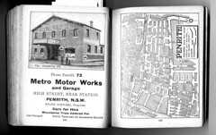
Penrith in 1926 according to Wilson's. Love the old garage.


Penrith_Wilsons 1926_293
Originally uploaded by gtveloce
There's a lot to enjoy here - the old Penrith garage in the advert to the left, the 1926 Penrith streetscape.. what about the amazingly narrow bridge over the Nepean River... was it even passable by opposing traffic?

Click through for more personal research and opinion on Sydney history.

Street directory and associated material, scanned for historical research purposes only. Attribution for street directories to HEC Robinson and Gregory's Maps, now UBD. As I say, it's for historical reference only.

Victoria Park racecourse - Waterloo according to Wilson's 1926


Waterloo_Wilsons 1926_291
Originally uploaded by gtveloce
Nice layout shown here for Victoria Park racecourse, including the tramway on reserved track (probably through a paddock?). Of course it's no more, replaced by a succession of English car makers culminating in the Leyland car plant that built the P76. When the wheels fell off that in the mid-70s it became a Navy supply yard before finally rebirthing as the new suburb of "Green Square", or whatever they call it. To me it's still Victoria Park.

Early aviators such as Defries used Victoria Park racecourse as an airfield (of sorts).


Street directory and associated material, scanned for historical research purposes only. Attribution for street directories to HEC Robinson and Gregory's Maps, now UBD. As I say, it's for historical reference only.

or checkout my list of Sydney and surrounding airstrips and airports. 

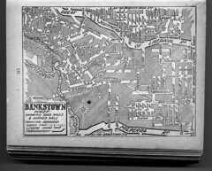
Bankstown West according to Wilson's 1926 street directory


Bankstown_Wilsons_1926_547
Originally uploaded by gtveloce
It's 1926 and Liverpool Rd is also "Great Southern" Road. Marion Street is shorter and there's a blank canvas awaiting for Bankstown Airport.

Click through for more personal research and opinion on Sydney history.

Street directory and associated material, scanned for historical research purposes only. Attribution for street directories to HEC Robinson and Gregory's Maps, now UBD. As I say, it's for historical reference only.

Tuesday, June 22, 2010

Bike racing circuits of Sydney... mapped

Where have we raced our bikes in Sydney? Lots of places. Cycling was the workingman's way to travel long distances before mass production of the motor car. The bike was ridden everywhere (if someone tells you that Sydney's 'too hilly' for bikes just laugh - they have no idea what's possible on a bike) and inevitably raced.

It's a work in progress, but here goes....

Crit circuits and velodromes in the Hurstville area: 
Oatley Park (St George club criterium circuit)

Olds Park, Penshurst (cycling circuit around circumference of park). Raced at least once, possibly during a Commonwealth Bank Cycling Classic in the late '80s?)
Hurstville Oval (a shallow-banked velodrome), track racing venue for St George Club.

Kempt Field, another Commonwealth Bank Cycling classic stage venue. Narrow track in parts with some twists, sandy edges and a steep-ish climb every lap. 

And - reportedly - there was a small, steep indoor velodrome at Railway Parade, Carlton. The building appears to have gone/been remodeled but I did check it out on the early 1980s when it was an art warehouse. It was certainly old, full of iron spars and posts but there was hardly enough space between the ironwork to race track bikes... surely? More investigation needed.

Crit circuits in the Sutherland area:

Waratah Park - Sutherland Club - several useful criterium loops including the main, long circuit that drops way, way down (ie potentially very fast) and turns hard left before climbing back up to the main straight.

Crit circuits and velodromes in the Eastern Suburbs:

Riley Street (old, long-lost, steep timber velodrome, later moved to Canterbury)

Heffron Park, home of Randwick-Botany and Eastern Suburbs clubs, a 2.2km circuit with plenty of twists, a hill and a long, long finishing straight.

Coogee - a street circuit used in the Commonwealth Bank Cycling Classic

Bondi Beach - the promenade, used by the Randwick Club before traffic got the better of it all

Bunnerong Road - a road course used after Bondi beach was no longer available but before Heffron came about

Centennial Park - a regular venue for road championship cycling.

Western and Inner Western Sydney crit circuits and velodromes:

Merrylands Oval (saucer velodrome)

Canterbury (old Riley Street timber velodrome, moved)

Tempe (or Canterbury velodrome, a concrete twin of Chandler in Brisbane)

Wiley Park (banked outdoor velodrome lost to road widening)

Bass Hill (crit track and indoor timber velodrome)

Camperdown (now closed, a concrete velodrome that replaced the Empire Games track at Henson Park)

Blacktown criterium track

Lidcombe Oval (outdoor velodrome)

Lansdowne Park, a twisty criterium course with a decent hill

Henson Park (the 1938 Empire Games velodrome)

As always, more soon...

or checkout my list of Sydney and surrounding airstrips and airports. 

Where was....

Where was Amaroo Park? North west of Sydney, in Annangrove. Now redeveloped.

Where was Oran Park? South west of Sydney, now redeveloped. Near Camden and Narellan.

Where was Catalina Park?The track remains but is unusable for motorsport (and unsafe anyway!). Was used for rallycross but looks abandoned now. The track can be ridden (bicycles) or walked. 

Where was Maroubra Speedway? On the hills above the beach, to the east of Anzac Pde.

More to come....

Here is an updated list of Sydney's airports.   

Tuesday, June 15, 2010

The type of emotional rhetoric used to close an airport - in this case Hoxton Park but today's events will lead to more calls for Bankstown to close

It's obviously a traumatic and sad event when an aircraft crashes with a loss of life - and we don't need local agitators jumping on the bandwagon. But they will. Of course aircraft don't crash on approach or departure from Bankstown as regularly as cars and trucks crash on our roads - far from it - yet the fear campaign will be all about the unsuitability of having an airport adjacent to houses, schools and offices. It may be a statistically low risk but it's an emotive issue, especially so immediately after a crash occurs. It's ghoulish and sad that people will use this event in a manipulative way, but it will add to the aircraft noise debate (arguably the real issue) and may eventually cause Bankstown to be reduced in scope, or to close. Perhaps.

Sometimes issues just mount up and force a hand. Further to the west of Sydney Hoxton Park has closed, at least partly because of the fear campaigns of elected parliamentary members just "doing their job", and partly in aid of a bigger transport picture involving airport privatisation and development. The end result is another airport closure, putting more pressure on existing facilities - like Bankstown.

Now Bankstown airport has been around a long time (planned in 1929 but built during WWII) and pre-dates much of the industrial and residential development that now surrounds it. Indeed it is hemmed in and further growth is impeded. And as Sydney's airfields have closed - many of the WWII airfields such as Castlereagh or Fleurs lasting only into the '50s or at best early '60s - others have taken up the slack, like Bankstown, Camden, Wedderburn and The Oaks (despite the quote below very much an active field) . Be they the late lamented Naval Air Station at Schofields or the more recent closure of Hoxton Park the loss of landing strips forces light to medium aircraft users, owners and operators into either more distant airfields like Wedderburn or The Oaks or into busier ones like Bankstown. And we aren't actually opening any new ones, are we?

By the way I'm hardly a silvertail (read below for the bald faced rhetoric), having grown up in Marrickville in the 60's. I don't fly any more but the point is that private pilots can come from any socio-economic background. That's what our egalitarian society is all about - opportunity coupled with fairness and social mobility. Or is that just rhetoric as well?  

Hoxton Park Airport - 07/05/2002 - NSW Parliament
Mr LYNCH (Liverpool) [4.41 p.m.]: I ask the House to note as a matter of public importance Hoxton Park Airport and the surrounding suburbs. Hoxton Park Airport is located within my electorate and it is the subject of considerable controversy. Both in terms of the safety of residents living around it and in the amenity of their neighbourhoods, a substantial number of people have been calling for the airport's closure. The suburbs surrounding the airport include Cecil Hills, Green Valley, Hinchinbrook, Hoxton Park and West Hoxton. I have called for the closure of the airport on previous occasions, and I restate that call today. I have raised this matter on a number of occasions in this House. Indeed, I debated an urgent motion on the matter in 1999. It is appropriate to raise the matter again today because only several weeks ago there was a further accident at the airport.

Hoxton Park Airport is a general aviation airport. It covers 85 hectares and has one sealed runway that is 1,098 metres in length. It is open 24 hours a day, seven days a week. However, circuit training is restricted to between 6.00 a.m. and 11.00 p.m. on Mondays to Fridays, 6.00 a.m. to 10.00 p.m. on Saturdays, and 6.00 a.m. to one hour after last light on Sundays. It caters to both fixed-wing and rotary-wing aircraft, that is, planes and helicopters. It is usually busier on weekends than on weekdays, which says something about the people who are using the airport to train. As I understand the evidence, an average of about six or seven planes are in the air around the vicinity of the airport at any given time.

The airport was originally constructed in about 1942 as part of a group of airfields to be used as aircraft dispersal fields in anticipation of a Japanese air attack. Others included Menangle, Bargo, the Oaks, Wallgrove, Fleurs, St Marys, Castlereagh, Pitt Town and Ettalong. Interestingly enough, none of those airfields is currently operating as an airport. RAAF pilots also used Hoxton Park Airport for training purposes and the like. After the war the airport was leased to the Hardy Rubber Company for use as a tyre test track. Eventually its use as an airport was resumed, but its current use is very different to what it was then. It is now used overwhelmingly for training purposes.


Speaking of developers eating airports, how about Cooranbong, north of Sydney?

Bankstown, Mascot and Hoxton Park are clear examples of developers gradually surrounding an airfield and then absorbing it, either completely or at least on enough sides that the airport becomes "hemmed in" and unable to operate optimally - or to possibly expand (short of reclaiming Botany Bay, for example). And then the complaints start. The noise and the "danger" of it all. As if getting hit by a motor vehicle wasn't an order of magnitude more likely.  

I mentioned also the pressure on Warnervale airport due to changing patterns of land use and the incursion of residences into flight (and thus noise) zones - and then I stumbled on another airfield with an interesting history as well as pressure to convert and rezone its use: Cooranbong, to the northwest of Warnervale.

"Heritage Impact Assessment of the Cooranbong Aerodrome in the context of potential rezoning and a concept master plan. The property has been assessed to have some local community heritage value, primarily for social and historic association, in the use by the Adventist Aviation Association, established 1973, and their aircraft assisted volunteer country outreach and missionary programs. There are secondary levels of significance, such as the formation of the main strip by early Adventist community members in the late 1940s, and the development of a flying school in the late 1970s. The size and scale of the airstrips form distinctive landmarks when viewed from the air.

The proposal sets out the re-zoning of the site to allow for future development, and the concept master plan comprises pockets of developable areas set within retained areas and corridors of natural bushland. The airstrips have been incorporated into the future road patterns planned for the site and will remain prominent elements that contribute to the heritage nature of the place. Areas of open space allowing for specific heritage interpretation are planned into the scheme."


In many ways transport has defined European settlement in Australia and set the pattern for development. Where we found a sheltered haven we built a port. Where we laid tracks towns formed. Where roads joined or rail was laid junctions were created and new focuses and possibilities came into being. It's the timing of transport development that gradually shaped where we lived. Obviously we had reasons other than transport alone - arable land, water and adequate shelter were all factors, sometimes key ones. The Central Coast relied for many years on timber felling for example, which led to a need for tracks and trails, railways and ports. We then link isolated towns and create alternatives to the ports, leading to a de-emphasis on one mode of transport. It is this decison making - or perhaps non-making - that shapes our direction. Cooranbong is an interesting example of this:

"Cooranbong was an important river port with up to ten ships trading here regularly for timber and agricultural produce. The town had a courthouse, shops, hotels and a ship yard. When the northern railway was coming, it was expected to pass through Cooranbong with a branch line to Newcastle and the main line to pass under the Gap as it went further north. The town’s people saw the town as the administration centre of the south. But the line was eventually built through Morisset and over Dora Creek. This prevented the sailing ships from coming up the river and Cooranbong rapidly went into decline dropping the population from 700 to less than 200 in five years. About that time the Adventists arrived and moved the town a mile to the east ignoring the old town and to a large degree, the local people."   

‘Cooranbong’ is from an Aboriginal word meaning rocky bottom creek or water over
rocks. This is Awabakal peoples land. 

And Cooranbong also has an interesting aviation history:

"Between 1932-37 a few local aviation enthusiasts including Albert Harris built a Piertenpole, a high-wing monoplane, in the fowl houses and tool sheds in different parts of the town. The plane was made from crude parts including a ten-year-old, four-cylinder motorcycle engine; a homemade contraption mounted underneath the wing as an airspeed indicator, and barrow wheel tyres. The only instruments were an oil pressure gauge and a rev. counter.
"

First flight was from "Miller's paddock", now Meyers Crescent, off Alton Road.
Don't try landing there now.

With an early airfield as well...
"The same enthusiasts made the first airstrip on the southern side of Cooranbong near the Post Office (near present day Martinsville Road). The site was bounded at one end by a dry creek and at the other end by telephone lines. It was 300 yards long. The Civil Aviation minimum requirements at that time were 500 yards. Despite not meeting regulations, the site is reported to have been used by the group until the outbreak of WWII."

 Don't try landing there, either.

And interestingly there's a link between Cooranbong and 'Wamberal airstrip':

"Harris and the other notable local enthusiast, Frank Wainman, put a second remodelled plane together. Intermediate tests with some crashes were performed on the first early Cooranbong strip, however the main tests for that plane was at Wamberal airstrip. Frank Wainman’s first solo trip was during one of these tests at Wamberal and resulted in the wreck of the second plane."


And the current - now closed - airstrip was created by clearing land circa 1946. And an east-west strip was added circa 1977 and other upgrades led to a flying school being established. It's a fascinating history well worth reading at the heritage planning site I have been linking to.

That heritage impact assessment document concludes negatively in regard to conserving the airfield itself but recommends using the runway alignments as a feature of any new development. The argument sounds reasonable in a heritage sense but does mean that another aviation resource - and one hard to replicate - is lost. But we'll have a memory imprinted in the roadscape, won't we? Better than nothing, I suppose.

Making Time for Flying: Moisture in the air and water in the tanks
I flew past the Cooranbong aerodrome, which is no longer used as one can tell from the big white crosses at the threshold of each runway. It's sad because it looks like a very nice airport, with a long sealed runway. Apparently, Avondale College used to run an aviation degree out of here up until 2006.
Hmmm, no, I wouldn't land there, either. And this is what we've lost (all images via Google Maps):
Still, it's a free country. Well, it's free in some senses. And in the end economics - and regulation - win. The airport (and the adjacent Avondale College) shown above was developed by the Adventist organisation over many years. It's their back paddock, after all, and they need to make best economic use of the land they can, within the laws of the land and the bounds of their beliefs. So be it.

The airport was just an idea, a concept, in 1946, and was 'opened' in 1949. It's quite an interesting story in itself. 

Checkout my list of Sydney and surrounding airstrips and airports.

Warnervale - an active airstrip north of Sydney

I feel like I'm cataloging airfields now, but each has a rich history and I intend coming back in due course to fill in the blanks.

Warnervale is in the Wyong district north of Gosford. It's an important regional airfield and one of the few remaining strips between Sydney and Newcastle. These days we have to catch a train or drive our cars first if we want to fly... and whilst flying is not the most fuel-efficient method of transport it's hardly going to be enhanced by extra car or truck journeys, is it? Alas airfields tend to secure an expanse of grass for runways and overruns, eventually attracting developers bent on turning the "wasted" grassy fields into houses or industrial estates. The airport itself may attract additional investment, leading to jobs, and further development. Which is a downward spiral leading to airport closure when newly local residents complain about the aircraft noise. Warnervale is secure for now but the fight to remain active is always on the horizon.  

Making Time for Flying: Moisture in the air and water in the tanks
After Patonga I adjusted my heading slightly toward Warnervale at 3500ft, with still lots of clouds in the Kariong area. I found Warnervale aerodrome, which is not really a challenge given its prominent location between the Pacific Highway and Tuggerah Lake. One lonely Cessna 152 was doing circuits at Warnervale. I made a call on the CTAF frequency advising everyone I was overflying the aerodrome and kept tracking north.
Here is an updated list of Sydney's airports.  

Monday, June 14, 2010

Wedderburn, Wallacia, Wilton: the hidden airfields of Sydney starting with "W"

I've become a bit obsessed with the subject of the airports, airfields and landing strips that either exist now or existed once in the greater Sydney region. You may have noticed a few posts on this subject recently... well here's another one!

I have previously mentioned Wedderburn. Wedderburn airfield has a single runway, 17/35 measuring approximately 950 m (3,120 ft) long. There are some interesting historical pics in the Sport Aircraft Club's gallery from the Campbelltown City Council collection. It's a post-war private field that has grown somewhat since closure of Hoxton Park.

I should mention Wallacia. Wallacia airstrip was on Park Rd, Wallacia. It is no longer in use, indeed it's not really visible to me at all - not a trace! I also have found little historical information on ownership or use. I do know that it was adjacent to a Wildlife Park (Bullen's Animal World) and was used as carparking during a music festival in 1971.

Wikipedia says this about Bullen's Animal World:  
Bullen's Animal World was a circus style theme park located at Wallacia on the outskirts of Sydney. Its address was 11 Park Road, Wallacia. It was opened in 1969 by Stafford Bullen, the son of circus founder Alfred Percival Bullen, and operated until 1985.

And there's Wilton, of course, an active former WWII "dispersal strip" with 3 crossing runways in a triangular arrangement. At least 2 runways are visibly operational. Wilton is a skydiving centre with  some growth occuring since the closure of Hoxton Park airstrip. Wilton is located along the Hume Motorway, south-west of Sydney.
Wilton was considered as the site for the "2nd" major airport for Sydney but after much opposition and consternation plus decades of indecision Badgery's Creek is the current formally selected and 'semi-funded' site. We'll see what happens, I guess!


or checkout my list of Sydney and surrounding airstrips and airports.