Some varied history and observations about Turramurra, a suburb in the north and west of Sydney, split by the north shore rail line and the Pacific Highway. Anecdotally the northern side of the suburb is the place to be if you happen to like big houses, big cars and expansive lawns and gardens. The Pacific Hwy was variously in parts called either Lane Cove Road or Gordon Road up to Pearces Corner, where Peats Ferry Road began.
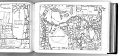
Geological Sites - Especially around Sydney

Geological Sites - Especially around Sydney
TURRAMURRATurramurra, New South Wales - Wikipedia, the free encyclopedia
Lovers Jump waterfall. Lovers Jump (locally also known as Lovers Leap) is a waterfall with a significantly large pool at its base, on the northern side of Burns Road between Finchley Place and McRae Place. A pool at the base of the waterfall is not known to have ever dried up, even though the creek may periodically run dry. The relatively deep valley of Lovers Leap (Lovers Jump) Creek below the waterfall has an area of remant Blue Gum High Forest ecological community. Brush turkeys in groups of up to 4 or 5 lives along the creek and the birds are seen in McRae Place where nesting mounds have been built and chicks have emerged in recent years. Also known in the area are lyre birds, owls, lizards like the water dragon, water rat, eels, etc. No particular reason for the waterfall development here is apparent. The creek at the top of the falls is probably close to the top of the Hawkesbury Sandstone. Where McRae Place makes its first bend (to the east) shale has been met with in digging on the northern side of the road, and close downslope from here the sandstone outcrops. This is probably an accurate elevation point for the base of the Mittagong Formation. Opposite the entrance to McCrae Place, on the south side of Burns Road, building excavation in 2007 exposed weathered Ashfield Shale passing down into Mittagong Formation. Near here was Irish Town. For a time this was an isolated community of orchardists who settled after 1850, with frequent intermarriage and picnicing at the Lovers Leap waterhole (fide Ku-ring-gai Historical Society). Irish Town is remembered by the small "Irish Town Grove" creek reserve between Bannockburn Road and Adams Street; although some accounts state that much of North Turramurra was known as Irish Town. The orchards are also remembered by the Orange Green park behind North Turramurra public school. This school was opened in 1914 to serve the community of orchardists, market gardeners and dairy farmers. In 1920 fruit fly proved disastrous to commercial orchardists on the North Shore
Turramurra is a suburb on the Upper North Shore of Sydney, in the state of New South Wales, Australia. Turramurra is located 17 kilometres north of the Sydney central business district, in the local government area of Ku-ring-gai Council. North Turramurra and South Turramurra are separate suburbs.[1]Turramurra, New South Wales - Wikipedia, the free encyclopedia
Early settlers referred to the area as Eastern Road until the name Turramurra was adopted when the railway station was built here in 1890. One of the early local landmarks was Ingleholme, a two-storey Federation home in Boomerang Street. It was designed by John Sulman (1849-1934) as his own home and built circa 1896. The house was part of the Presbyterian Ladies College for some time afterwards and is now on the Register of the National Estate. It is notable as an example of John Sulman's style.[2] The first post office opened in 1890. The Hillview estate was marked for heritage listing.[3] Another humble landmark is St Andrew's in Kissing Point Road, which is an example of the Federation Carpenter Gothic style.Ku-ring-gai Historical Society - Local history - Turramurra
Turramurra is an Aboriginal word meaning ‘high hill’ or ‘big hill’. When the railway was opened on 1 January 1890 the suburb was called Eastern Road after the border of one of the major estates in the area. This was changed to Turramurra on 14 December 1890 as it was thought more appropriate the suburb have an Aboriginal name.
Turramurra is a large suburb, extending from the Lane Cove National Park in the south to Ku-ring-gai Chase National Park in the north. Both these parks govern the boundaries of North and South Turramurra. The township of Turramurra is divided from Wahroonga by Finlay Road, Cherry Street, Brentwood Avenue then east to Eastern Road. From here it continues along Eastern Road to its junction with Burns Road, to swing south to a branch of Cowan Creek. On the Pymble side, the boundary goes south to Pentecost Avenue, west to Bobbin Head Road, then south again to the Pacific Highway. It crosses the highway, runs down along the edge of Rofe Park to end of the Lane Cove River...
In 1822 Thomas Hyndes leased and subsequently purchased 2,000 acres north of Robert Pymble’s grant. Turramurra was part of this lease, known afterwards as The Big Estate Lease.


 Here is an updated list of


 Here is an updated list of

